Viewing entries in
National Park

Arches National Park

Arches National Park

Arches is introducing a new timed entry system for summer 2022, see more info on the park’s website here.

Best time to visit: Year Around

Recommended Hikes/Walks: Delicate Arch, Devil's Garden, Park Avenue, the Fiery Furnace

Ideal For: Hiking, Auto-Touring, Biking

Where to stay: Moab (camping and hotels)

Park Website - Park Map

Useful Information:

  • Dogs - the general rule for dogs in national parks is that they must be leashed and are only allowed on paved areas, which includes parking areas, roads, and front country campgrounds. Dogs are not allowed on park trails, even when leashed.

  • Arches exists in an ecosystem where biological soil crust covers the desert floor. These biological structures are not dirt… they can take decades to form and they play an important role in the ecosystem. Please stay on trail!

  • A trip to Arches can be combined with a trip to nearby Canyonlands National Park. Read more about Canyonlands here.

  • Drinking water is available at the visitor center and at the Delicate Arch and Devil's Garden trailheads - bring your water bottles to fill up.

  • There is no shuttle service in Arches. The entrance gate and parking areas can be crowded but are usually manageable.

Arches National Park, located just north of Moab, Utah, is relatively small for a national park but boasts the highest concentration of natural bridges in the world. The best times to visit are spring and fall to avoid the summer heat and winter chill, but the park is open year-round. Light snow is common in the winter months.

Must See Attractions:

Delicate Arch - the best arch in the park and an icon of Utah. There is always a big crowd at Delicate Arch so be prepared to enjoy it alongside a bunch of other people. Seeing Delicate Arch requires a 3 mile roundtrip hike, read more about it in the hiking section below.

The Windows/Double Arch - some of the largest arches in the park and the easiest to access. Double Arch is especially impressive and the view from Window Arch towards Turret Arch is famous with photographers. Visitors can climb up beneath all the arches in this area for unique views of the rock overhead.

Balanced Rock - a massive boulder that is suspended high above ground by a thin spire of sandstone. You can see Balanced Rock from the road while driving, but it's worth parking and walking up close to appreciate how massive the boulder really is.

Devil's Garden - home to the famous Landscape Arch - the longest arch in the park. Other great arches in this area include Partition Arch, Navajo Arch, and Double O Arch. Read more about these arches in the hiking section below.

Fiery Furnace - a maze of sandstone and hidden arches that you can explore on a loop hike. A permit is required to see the Fiery Furnace which can be obtained at the visitor center up to seven days in advance. The ranger-guided tours are more popular, but don’t be afraid to go self-guided! Read more about the Fiery Furnace on the park’s website here.

Where to Stay:

Moab. It's a small town but it caters to the tourist crowd looking to explore Arches and Canyonlands. There are hotels, campgrounds, and RV parks, as well as stores, restaurants/bars, and places to book tours and adventure activities.

Drive times from Moab to national park entrances: 10 minutes to Arches National Park, 40 minutes to the Island in the Sky (Canyonlands), and 90 minutes to the Needles (Canyonlands). 

There is only one campground inside Arches NP, it can be reserved online in advance here. This campground is awesome and it's great for beating the crowds in the morning. Campfire wood is sold here by the campground host but there are otherwise no stores within the park's boundaries. 

Hiking in Arches:

Most of the hikes in Arches are pretty short with minimal elevation change. Where sturdy shoes with good traction to navigate the sections of slopped sandstone.

Delicate Arch - The best arch in Arches. The hike is about 3 miles roundtrip but with steady elevation gain on sloped sandstone. The trail ends at the base of Delicate Arch which is a jaw-dropping sight. If you only have time for one hike in Arches, this is the one to do. Read more about it here.

Devil's Garden - There are number of impressive arches found in the Devil's Garden.

The most famous is Landscape Arch - the longest arch in the park. The hike to Landscape Arch is flat but sandy. Massive chunks of rock have fallen from Landscape Arch in recent years - it may someday soon collapse entirely! Read more about the hike to Landscape Arch here.

The best hike in the Devil's Garden starts just beyond Landscape Arch, and goes to Partition Arch, Navajo Arch, and Double O Arch. There is a steep and slick section of rock just after Landscape Arch that you need to climb up to reach the other arches. It is easier to go up this section than to go down. This part of the hike can be scary and I have seen people turn around when they get to it, although most can make it up and down. If you want to avoid the steep section, this trail is actually a loop that can be accessed from the other direction on a longer loop trail. The full loop is worth doing if you have the time. Read more about it here.

Off the Beaten Track

Sand Dune Arch and Broken Arch are two cool arches near the Devil's Garden which are usually a little less crowded than the big attractions mentioned above. Sand Dune Arch is awesome and its always in the shade, making a great place for photography.

Corona Arch - This is a massive arch located near Moab, outside of Arches National Park. Its worth seeing if you are staying in Moab. Read more about it here.

Bryce Canyon National Park

Bryce Canyon National Park

COVID Info: Masks are required on shuttles and inside park buildings.

Best time to visit: Year Around

Recommended Hikes: Queen's Garden, Navajo Loop through Wall Street, Peekaboo Loop, the Hat Shop

Ideal For: Hiking, Horseback Riding, Camping, Auto-Touring, Backpacking

Where to stay: Numerous options for RV parks, campgrounds, and hotels just outside the park entrance.

Park Website - Park Map

Useful Info:

  • Dogs - the general rule for dogs in national parks is that they must be leashed and are only allowed on paved areas, which includes parking areas, roads, and front country campgrounds. Dogs are not allowed on park trails, even when leashed.

  • Hiking below the rim in Bryce NP is some of the most enjoyable hiking I have experienced to date. If you are able, I highly recommend venturing down into the canyon to see the hoodoos up close. This provides a much deeper perspective of the landscape than you can achieve from the viewpoints above.

  • The small town of Bryce lies just outside of the park entrance; it has restaurants, grocery stores, and places to stay (hotels, campgrounds, and RV parks).

  • It takes about 30 minutes (one-way) to drive from the park entrance to Rainbow Point at the southern end of the park.

  • A trip to Bryce can be combined with a trip to nearby Zion National Park and Grand Staircase Escalante National Monument.

  • Drinking water is available at the visitor center and at several major viewpoints - bring your water bottles to fill up.

  • Shuttles run during the summer half of the year from "Ruby's Inn and Campground/RV Park" which is just outside the park boundary to all the major viewpoints along the main amphitheater area. Parking can be limited, so using the shuttle can save a lot of hassle. The shuttles do NOT run further south to Natural Bridge or to Rainbow Point - you will need to drive to reach those destinations. There is no charge to use the shuttles - it is included with the park entrance fee.

Bryce Canyon is an otherworldly landscape of densely packed, free-standing rock spires called "hoodoos". The hoodoos run along a ridge that is about 15 miles long, but they are most abundant in a few mile section called the "Bryce Amphitheater" - referred to below as the "main amphitheater". Bryce is a year-round destination, but it gets significant snow during winter.

Must See Attractions:

Viewpoints - there are many great viewpoints along the rim of Bryce Canyon, accessible by car, park shuttle, and walking paths. All the major viewpoints in the main amphitheater are worth seeing, including Sunrise Point, Sunset Point, Inspiration Point, and Bryce Point.

Natural Bridge - this is a large and unique arch that is visible from a viewpoint just off the main park road. It's roughly a 20 minute drive to get here from the visitor center. There is no "below-the-rim" access in this area.

The following attractions are below the canyon rim - seeing them requires visitors to hike down at least 350 vertical feet, and also hike back up afterwards.

Queen's Garden - just beneath Sunrise Point, this is one of two areas in the main amphitheater that feature exceptionally large hoodoos. The Queen's Garden is impressive to witness from both above and below. There is a small hiking detour from the Navajo Loop that leads into the Queen's Garden. Read more about the hike here.

the Queen's Garden, Bryce Canyon National Park, Utah

Wall Street - Wall Street is essentially a slot canyon made of hoodoos. A single hiking path runs right through the heart of it and it's perhaps the biggest attraction in the park. Wall Street is located just below Sunset Point and it can be seen as a part of the Navajo and Peekaboo Loop hikes discussed below. Read more about the hike hereNote - Wall Street is closed when there are freezing temperatures - if you visit in winter, spring, or late fall, Wall Street will likely be closed.

Mossy Cave - There is a cool waterfall outside of the main park area, on a very short hike called “Mossy Cave”. The waterfall was created by people who redirected a creek in the 1800s'. There is also a cave near the waterfall. This area is worth seeing! Read more about it here.

Where to Stay:

There are more options for lodging outside the park boundaries in and around the small town of Bryce, including hotels, RV parks, and private campgrounds. Ruby's Inn is a good option for camping just outside the park and they have showers and wifi. 

There are two campgrounds within the park which can be reserved in advance. The North Campground can be reserved here and the Sunset Campground here - they fill up early so book well in advance if possible.

Hiking in Bryce:

Navajo Loop through Wall Street and the Queen's Garden - If you do one hike in Bryce, this is the one to do. It is a loop hike that connects Sunset and Sunrise Points with a 3 mile trek through the hoodoos. The trail leads through both Wall Street and the Queen's Garden which are both must-see attractions. Read more about this hike on the park's website here.

The famous switchbacks beneath "Thor's Hammer" on the Navajo Loop hike in Bryce Canyon.

Peakaboo Loop - Similar to Navajo Loop but longer - this trail leads down from Bryce Point on the south side of the main amphitheater and meets up with Navajo Loop at the base of the amphitheater.  Bryce Point has a higher elevation starting point, so climbing out is more difficult than Navajo Loop. Read more about the Peekaboo Loop hike here.

My favorite hike to do in Bryce is to combine the above two loops into a single "through" hike. If you start at Bryce Point, you can hike down to the amphitheater floor on Peekaboo Loop, and then turn left onto the Navajo Loop to see Wall Street. There are steep switchbacks that ascend from the other side of Wall Street up to the rim, but instead of taking those up, backtrack in the other direction on Navajo Loop. This will bring you along the valley floor to the Queen's Garden, which you can explore before making your final ascent out of the amphitheater at Sunrise Point. Bryce Point has a significantly higher elevation than Sunrise Point, so start the hike at Bryce Point for an easier climb out of the amphitheater. Make sure the shuttles are running before you do this hike! 

The rim trail is another great hike and it's a perfect option if you don't want to hike down into the canyon. The trail runs from Bryce point to Sunrise point, and then further north up to Fairyland Point from there. The trail has a slight decline from south to north, so it's best to park at Sunrise Point and then take the shuttle over to Bryce Point. From there, the walk along the rim back to your car will be mostly downhill.

The Hat Shop - If you want to escape some of the crowds in the main amphitheater, consider the hike to the “Hat Shop”. Its a few miles down the “Under the Rim Trail” which begins at Bryce Point. This is a good option if you have done all the hikes in the main amphitheater and are looking for something new. Read more about it here.

Off the Beaten Track:

Fairyland Canyon sits on the northern end of the park and is always much less crowded than the main amphitheater. There is a trail that descends from Fairyland into the valley and eventually runs into Navajo Loop, passing another natural bridge in the park called "Tower Bridge". The road out to Fairyland is not serviced by the shuttle system and is closed during winter. Read more about the Fairyland hike here.

Rainbow Point is at the very southern end of the park and it will also usually be less crowded than the main amphitheater. There are several hiking tails that descend below the rim from here, including the Under the Rim Trail which runs all the way to Bryce Point. This trail is cool but not nearly as scenic as the trails in the main amphitheater.

Canyonlands National Park

Canyonlands National Park

Best time to visit: Spring and Fall

Recommended Hikes: Elephant Canyon, Mesa Arch, Grand View Point, Druid Arch, the Joint Trail

Ideal For: Hiking, Backpacking, Auto-Touring, Camping, Off-Road Motor Sports 

Where to stay: Moab

Park Website - Park Map

Useful Info:

  • Dogs - the general rule for dogs in national parks is that they must be leashed and are only allowed on paved areas, which includes parking areas, roads, and front country campgrounds. Dogs are not allowed on park trails, even when leashed.

  • Canyonlands exists in a very fragile desert ecosystem. It is crucial to stay on hiking paths and not wander off trail as delicate, biological soil crust covers the desert floor. These living structures are not dirt! They can take decades to form and they play an important role in the ecosystem. Please don't step on them!

  • The "Needles" is better for hiking, the "Island in the Sky" is better for viewpoints/auto-touring. There are exceptions, but this is a good rule of thumb.

  • It takes a long time to drive from one district to another. DO NOT try to see both the "Island in the Sky" and the "Needles" in the same day, choose one or the other or split them into at least two separate days.

  • The "Maze" is the most remote district - driving here from Moab will take 5+ hours, one-way. There is no drinking water available and it's mostly only accessible to high-clearance, 4WD vehicles. Read more about the Maze on the park's website here.

  • A trip to Canyonlands can be combined with a trip to nearby Arches National Park. Moab is a perfect location to stay to be able to see the "Needles", the "Island in the Sky", and Arches.

  • Drinking water is available at the visitor centers in the "Island in the Sky" and the "Needles", but not at trail-heads. Bring your water bottle to fill up.

  • There is no shuttle service at Canyonlands.

Canyonlands is a massive, rugged landscape. It is one of the most underrated national parks in the country and you should plan at least two full days to see it. At it's heart is the confluence of the Colorado River and the Green River, which come together in a "Y" shape that divides the park into three districts: the Island in the Sky, the Needles, and the Maze. The "Island in the Sky" and the "Needles" districts are both easily accessible from Moab but require up to an hour of driving to reach. The "Maze" is not easily accessible from Moab - it is remote and requires advanced planning, high-clearance 4WD, and self reliance to visit. Spring and fall offer the most pleasant weather, but Canyonlands can be enjoyed year around. Expect some snow during winter months.

Must See Attractions:

Grand View Point - Located in the "Island in the Sky" District, Grand View Point is a must-see for every visitor. The tip of the plateau offers a 270-degree view of the vast canyons below. It's one of the best views in Utah! Read more about reaching Grand View Point here.

Mesa Arch - A popular photography spot and another must-see in the "Island in the Sky". The view of the arch faces east so this is a popular photography spot during sunrise. Its a half-mile round-trip hike from the parking area. Read more about Mesa Arch here.

Elephant Canyon - The premier attraction of the Needles District. Elephant Canyon is a great place to see the "Needles" up close. Seeing Elephant Canyon requires 5 miles of hiking at a minimum, so bring plenty of food and water. Outstanding day hikes to Druid Arch and the Joint Trail both begin at the Elephant Hill trailhead.

Where to Stay:

Moab. It's a small town but it caters to the tourist crowd looking to explore Canyonlands and Arches. There are hotels, campgrounds, and RV parks here, as well as stores, restaurants/bars, and places to book tours and adventure activities/off-road vehicles. If you want to do a lot of hiking in the "Needles" however, the best option is to camp in the district to avoid the long drive from Moab.

Drive times from Moab to national park entrances are: 40 minutes to the "Island in the Sky", 90 minutes to the "Needles", and 10 minutes to Arches National Park. 

There are campgrounds in each district of the park - they are first-come, first-served, but some of the sites in the "Needles" campground can be reserved online in advance here. According to the park website, the campgrounds fill up early every single day during spring and fall. 

There is a small private campground just outside the "Needles" entrance which is a good option if the campground in the park is full. Their website is here.

Hiking in Canyonlands:

Needles District

Elephant Canyon - If you have just one day in the "Needles" district, see Elephant Canyon. It requires a hike into the heart of the needles rock formations, and there is a network of trails to choose from once you get there. The trailhead is called "Elephant Hill" and it can be reached via well-maintained dirt road. There is a pit toilet at the Elephant Hill trailhead, but no water.

There are two primary options in Elephant Canyon that are both world-class hikes. One goes to Druid Arch and the other goes to the Joint Trail.

Druid Arch is massive - much larger than any arch you will find in nearby Arches National Park. The arch is surrounded by an amphitheater of sandstone, making this area a fantastic endpoint to the hike. There are a few easy rock scrambles and a short ladder you have to climb to see the arch. Read more about this hike here.

The Joint Trail is a grid of cracks in the rock that begins as a slot canyon and then becomes a cavernous arena of giant boulders. This is one of the coolest endpoints to a hike I have seen to date, and the trail to get here crosses through Chesler Park which is awesome in its own right. Read more about the hike here.

If you are in excellent shape and you carry a lot of water, you might be able to see both Druid Arch and the Joint Trail in a single, 14-mile loop hike. I personally prefer the Joint Trail, but they are both truly incredible. You will not be disappointed either way. 

Another popular hike in the Needles District runs out to the confluence of the Colorado and Green Rivers - I haven't done this one so I can't comment on it, but you can read more about here.

Island in the Sky District

Upheaval Dome - Another Island in the Sky hike, but one that can safely be skipped in favor of any of the above. Scientist speculate that the Upheaval Dome was formed by a meteor impact, although this theory is contested. Read more about the hike here.

There are a few options to hike down into the canyon from the "Island in the Sky". From what I have read, the trails are pretty steep and rugged with no shade or water, but still worth doing. 

Crater Lake National Park

Crater Lake National Park

Best time to visit: Summer

Recommended Hikes: Wizard Island, Garfield Peak, Mount Scott, Rim Trail, the Watchman

Ideal For: Camping, Auto-Touring, Hiking

Where to stay: Hotels or campgrounds in the park

Park Website - Park Map

Useful Info:

  • Dogs - the general rule for dogs in national parks is that they must be leashed and are only allowed on paved areas, which includes parking areas, roads, and front country campgrounds. Dogs are not allowed on park trails, even when leashed.

  • The south entrance to Crater Lake NP is open year around. During winter, there is one small viewpoint to see the lake - everything else is covered in deep snow. The north entrance to the park and the west rim drive open in late May or early June, and the east rim drive usually opens in early July. These roads close each year on November 1, or earlier if there is heavy snowfall.

  • Boat tours on the lake run when the east rim drive is open, which is roughly from July - September. Advanced reservations can be made online here.

  • All boat tours leave from Fleetwood Cove on the north side of the lake. To reach the lakeshore, visitors must hike down (and up) about 700 vertical feet from the rim. This is the only place where you can access the lake's shore.

  • There is limited lodging, gas, and food available at Rim Village and Mazama Village on the south side of the lake.

  • Crater Lake can be seen as a long day-trip if you are driving through Oregon. Even just an hour or two here will leave a lasting impression.

  • Drinking water is available at the developed areas on the south side of the lake - bring your water bottle to fill up.

Crater Lake is arguably the prettiest lake on Earth. The lake's blue color is intensely deep and vibrant, almost redefining the color itself. The park receives heavy snowfall each year, making winter and spring less than ideal times to visit. Summer is by far the best time to visit for good weather and access to the park's rim road and hiking trails. Boat tours run around the lake and to Wizard Island during the summer half of the year.

Must See Attractions:

Rim Road - There is a road that goes around the entire lake which has a ton of viewpoints - they are all worth stopping at if you have the time. Driving the full loop will take about an hour, not including stops. The entire loop is only open from July - October, but the western portion of it is open for longer. Read more about road access in the useful info below.

Wizard Island - When the boat tours are running, you can visit Wizard Island - a cinder cone volcano that rises up out of the lake. There is great hiking here to the top of the cinder cone and to Fumarole Bay, which has a swimming dock. Wizard Island is also a popular spot for fishing. You can book boat tours online in advance here

Phantom Ship - A cool little island on the south side of the lake. There is a viewpoint to see it which requires a short hike called "Sun Notch". Some of the boat tours go to this part of the lake also if you want to see Phantom Ship up close.

The Pinnacles - An area of jagged volcanic rock formations a few miles south of the lake. There is a single out and back road the runs to the Pinnacles overlook from the east rim drive.

Where to Stay:

There are cabins and a campground at Manzama Village on the south side of the lake - click here for the website. There is also a historic hotel called the "Crater Lake Lodge" which sits on the south rim. It has a restaurant, deck, and rooms that have views of the lake. The lodge can be booked online here. Book as early as possible - everything fills up in advance. 

There is also a small, first-come-first-served campsite in the park called Lost Creek Campground, but it only has a handful of campsites. It is located on the road which runs out to the Pinnacles.

If you can't secure affordable lodging in the park, the small city of Klamath Falls is about an hour's drive south of the park. 

Hiking in Crater Lake:

There are a handful of hikes that climb to peaks surrounding the rim, including the Watchman, Garfield Peak, and Mount Scott. All of them are covered in snow well into the summer, so they are best done during late summer or early autumn.

The Watchman is the shortest of the three hikes and leads to a nice viewpoint high above Wizard Island. The trail is well maintained is a good option for anyone who wants to reach a highpoint without too much effort. Read more about the hike here.

Garfield Peak is a longer hiking option and my personal favorite in the park. The peak offers great views of the lake and is a good vantage point to see the Phantom Ship island. Read more about the hike to Garfield Peak here.

Mount Scott is the longest hiking option in the park and it reaches the highest peak in the park as well. While the hike is fun, it’s worth noting that the view from the peak is pretty far from the lake and doesn’t quite compare to the close-up views at Garfield Peak or the Watchman. There is a fire lookout station at the peak and great views of the landscape surrounding the crater. Read more about the hike here.

There is another great trail that runs along the rim from the Rim Village to the Watchman on the crater's south-west side. This hike is perfect for getting out of the car and away from the crowds with continuous views of the lake as you hike. This trail is relatively flat compared to the three peaks discussed above.

Wizard Island - only accessible via boat tour during summer months. The summit of the cinder cone is an awesome short hike, and if you move quickly, you can also see Fumarole Bay on a standard 3-hour visit.

Death Valley National Park

Death Valley National Park

Best time to visit: November through March

Recommended Hikes: Sidewinder Canyon, Mosaic Canyon, Golden Canyon, Mesquite Flat Sanddunes

Ideal For: Hiking, Camping, Auto-Touring, 4WD Auto-Touring

Where to stay: Campgrounds and hotels at Furnace Creek or Stovepipe Wells

Park Website - Park Map

Useful Info:

  • Dogs - the general rule for dogs in national parks is that they must be leashed and are only allowed on paved areas, which includes parking areas, roads, and front country campgrounds. Dogs are not allowed on park trails, even when leashed.

  • There are great hiking options in Death Valley - but they can't be hiked during summer. Visit in winter to enjoy these routes and explore hidden slot canyons.

  • If driving through the park during summer be weary of overheating you car. The road from the valley to the west entrance gate is steep and can be hard on older vehicles.

  • The park's north entrance and Scotty's Castle are currently closed due to flood damage. It is scheduled to re-open in 2019/2020. Access to Ubehebe Crater and the Racetrack is open from the south.

  • There are gas stations and small general stores at Furnace Creek and Stovepipe Wells.

  • Drinking water is available at the visitor center and campgrounds - bring your bottles to fill up.

  • There is no shuttle service in Death Valley National Park.

Death Valley is the largest national park in the lower 48 and one of its most underrated. The valley is striking and imposing with steep, rugged mountains that tower above canyons, salt flats, and sand dunes. There is a ton to see here and drive times between attractions are long. The park's huge size makes it feel less crowded than most national parks, even during peak season holidays.

Death Valley is a winter park - visit November through March to be able to hike and see all the canyons. Summers are too hot to visit and older cars may overheat when driving through.

Must See Attractions:

Badwater Basin - The lowest point in North America and a great place to see some of Death Valley's expansive salt flats. Look for the "Sea Level" sign high up the side of the cliff above the Badwater Basin parking area. 

Natural Bridge - An impressive arch made of rocks and mud that have been cemented together over the eons. The arch is about a half mile from the parking area and requires a slightly uphill hike to see.

Mesquite Flat Sanddunes - The most fun place in the park. The dunes are located in between Stovepipe Wells and Furnace Creek and you can hike across them for as long or as short as you please.

Ubehebe Crater - A deep and impressive volcanic crater - formed from underground fault lines. It's a pretty long drive to get here but its right on the way to the Racetrack if you are heading out there. 

Devil's Cornfield/Devil's Golf Course - Two cool areas that are easily accessible from the main park road. Seeing these attractions will only take about 10 minutes each.

Dante’s View - There is a really cool viewpoint of Death Valley from high above Badwater Basin at Dante’s View. The viewpoint is accessible via paved road and is worth seeing if you have time to make the drive. There is a short hiking trail in this area as well.

Racetrack Playa - Home of the famous "sailing rocks" of Death Valley. You will have to drive 50 miles on rough dirt roads to get here. This drive might be doable for a sedan but it would be extremely slow (under 10 mph) and the cost of getting towed out if anything goes wrong is very expensive. If you have your heart set on seeing it and are worried about your car, you can rent a jeep at Furnace Creek

Where to Stay:

Furnace Creek and Stovepipe Wells both have hotel options and camping options. Both spots are right in the heart of the park and are ideal for exploring Death Valley in its entirety. The park's large size makes staying outside its boundaries unrealistic.

Furnace Creek has a large campground that can be reserved online in advance here. It also has cabin style rustic lodging and a modern hotel which can both be reserved here.

Stovepipe Wells has a small campground which is first-come-first-served, and a rustic hotel which can be reserved here.

There are several more primitive campgrounds throughout the park which are first-come-first-served. They are at higher elevations which make them ideal if you are looking for somewhere to camp in hotter months. 

Hiking in Death Valley:

There are a lot of really cool canyons up and down the valley that you can hike. There are slot canyons, arches, and dryfalls (dry waterfalls) throughout these routes. 

Sidewinder Canyon - This is a must-do hike and it's not very well known. The hike is up a major wash with 4 distinct slot canyons branching off from it. The slot canyons are all located on the right side of the wash as you hike up, and there is a good chance you will have them all to yourself. The trail is not marked on the map, but the trailhead can be found roughly 32 miles down the Badwater Road. Read more about the hike and finding the canyon here.

Mosaic Canyon - Another must-do hike with prominent dryfalls and marble walled slot canyons. The bottom section of this hike is pretty crowded but it becomes more and more empty as you hike further. There are two sections that seem like they are impassable, but if you read the hike description here, you will find instructions on how to get passed them. 

Golden Canyon - This is probably the most popular and crowded hike in Death Valley. Golden Canyon is made up of yellow hills and ridges that look similar to the rock formations found in Badlands National Park. It has several route options which allow for customization. Read more about Golden Canyon here.

Click here for more Death Valley hikes and route descriptions.

Parts that I missed

Scotty's Castle - Currently closed due to flood damage, but scheduled to open in 2019/2020.

Titus Canyon - A steep dirt road leads through Titus Canyon which is one of the most popular canyons in the park. There are also a few hiking options in Titus Canyon. Read more about it here

Dirt Road Destinations - Besides the Racetrack and Titus Canyon, there are many more destinations that you can reach via dirt roads. There are several canyons on the west bank of the valley that look to have cool hiking routes, and another dune field at the very northern end of the park called the "Eureka Dunes". 4WD vehicles are best to explore these destinations.

Denali National Park

Denali National Park

the Denali Park road had a rockslide at mile 43 in 2021 which likely won’t be fixed this year. The Eilsen Visitor Center and Wonder Lake will not be reachable in 2022. See much more info from the park here.

Best time to visit: Summer

Recommended Hikes: Savage Alpine Trail, Mt Healy, Eielson Alpine Trail

Ideal For: Hiking, Back-country camping, Wildlife Viewing, Flight-Seeing, Mountain-Climbing

Where to stay: Campgrounds in the park, Towns of McKinley Park and Talkeenta

Park Website - Park Map

Far and away the tallest and most imposing mountains in North America - Denali National Park is a vast, pristine wilderness. The southern half of the park is made up of jagged peaks and glaciers, including the 20,310 foot Denali. The northern half is mostly tundra, home to all of Alaska’s famous wildlife. Summer is the best time to visit Alaska to take advantage of good weather and super long days.

What to Expect from Alaska:

  • Drive times are brutally long. Expect traffic delays throughout the state due to road construction during summer.

  • Always be prepared for rain. Weather patterns change quickly and forecasts are often wrong even one day in advance.

  • Lodging is expensive and generally not luxurious. Campgrounds are abundant and far more affordable.

  • Don’t try to see too much. If something in Alaska is a must-see for you, budget extra days in that area and consider skipping attractions that aren’t nearby.

Denali - Must See Attractions:

Talkeetna - This awesome little town is basecamp for mountain climbing and flight seeing in Denali National Park. Talkeetna is just 60 miles south of Denali’s peak, and on clear days, the sight of it from town is jaw-dropping. Activities in Talkeetna include Denali Flight-Seeing, river rafting, fishing excursions, ATVing, and jet-boating. I recommend Talkeetna Air Taxi if you are interested in flight-seeing.

video from a flight with Talkeetna Air Taxi in Denali National Park

Denali Sled Dogs (closed for Summer 2021) - The sled dogs of Denali spend the winter patrolling the park and the summer entertaining park visitors. The daily demonstrations are closed for 2021 due to Covid, but visitors can still stop and see some of the dogs and speak with park rangers.

Denali Bus Tour - The northern tundra area of the park is accessible via park bus tours and it offers the best chance to see Alaska’s wildlife. The tour busses can be reserved online here. There are two types of tours - the less expensive one is the better option (in my opinion). Both tour types will stop for any and all wildlife sightings.

Eielsen Visitor Center and Wonder Lake - These are the last two stops on the bus tour and they offer the best views of Denali’s north face - the “Wickersham Wall” - which is the highest continuous mountain rise in the world. The bus tours start running to these destinations in early June and close in mid September.

Denali State Park - About halfway between Talkeetna and the National Park entrance. There are two major viewpoints of Denali in the State Park, and a couple of nice lakes. Kesugi Ridge is a popular backpacking destination in the area.

Where to Stay:

There are a lot of lodging options in the town of McKinley Park near the park entrance. The hotels are all pretty expensive.

There are six campgrounds in the park, and several more private campgrounds in the area surrounding McKinley Park. Camping is much more affordable than the hotels. Campgrounds in the park can be reserved online here.

Hiking in Denali:

The park is famous for “off trail” hiking. You are allowed to hike anywhere across the tundra, except for certain wildlife closures. There are also a few official hiking routes in the park, discussed below:

Mt Healy - A popular trail near the parks entrance - the hike climbs 1,700 vertical feet for a great view of the mountains in the area, although there are no views of Denali. The bottom half of the hike is below the treeline, making it potentially dangerous for moose and bear encounters. Read more about the hike here.

Savage Alpine Trail - This trail runs from Savage River to the Savage River Campground, but the best part of the trail is right near the parking area at Savage River. Most of the trail is above the treeline and it offers views of Denali on clear days. Read more about it here.

Eielson Alpine Trail - There is an awesome trail that departs from the Eielson visitor enter and climbs high with consistent views of Denali. The hike is harder to access given it’s at the very end of the bus tour - book an early bus if you want to do this one. Read more about it here.

Glacier National Park

Glacier National Park

Glacier is requiring tickets to access the Going-to-the-Sun Road for summer 2022. Click here for more info and to reserve in advance.

Best time to visit: Late Summer

Recommended Hikes: Avalanche Lake, Grinnell Glacier, Two Medicine Lake, Hidden Lake, Highline Trail

Ideal For: Hiking, Wild-life Viewing, Backpacking, Camping, Auto-Touring

Where to stay: On the east side of the park (St. Mary, East Glacier, or Many Glacier)

Park Website - Park Map

Useful Info:

  • Dogs - the general rule for dogs in national parks is that they must be leashed and are only allowed on paved areas, which includes parking areas, roads, and front country campgrounds. Dogs are not allowed on park trails, even when leashed.

  • Glacier NP is frustratingly seasonal. Snow lasts well into summer and comes early in fall, with prime visiting season during summer.

  • Beware of fire season - Late summer is great for open roads and trails, but forest fires can render mountain peaks obscured behind smoke.

  • It's best to get lodging on the east side of the park to significantly reduce daily drive times. There’s a lot more to see on the eastern side of the park than the west side.

  • Glacier is home to both black bears and grizzly bears - proper food storage is required at all times, and extra caution needs to be used whenever hiking in grizzly territory. Read more about bear safety here.

  • There are boat tours on numerous lakes throughout the park - click here to read more about them and to book online.

  • Drinking water is available at most developed areas of the park, including visitor centers and campgrounds.

  • There is shuttle service that runs the length of the Going-to-the-Sun road during late summer only - using the shuttle is a good way to avoid the hassle of parking, but it can be slow and crowded. There is no charge to use the shuttles - it is included with the park entrance fee.

  • Glacier also has two private tour companies that run bus tours on the Going-to-the-Sun Road. These are not free, but offer a more in-depth experience than the crowded shuttle system. Read more about the bus tours here.

Glacier is "the" favorite national park for a lot of outdoor enthusiasts. It is massive and has a lot to offer, with great wildlife-viewing, outstanding hiking, waterfalls, lakes, and mind-blowing mountainscapes. It is a highly seasonal park - almost everything is closed for most of the year, except for summer. Late summer is best for snow-free hiking routes and roads. Early summer offers its own advantages, including smaller crowds and stronger flowing waterfalls. 

Must See Attractions:

Going-to-the-Sun Road - The park's most famous attraction. The road is closed for most of the year, but opens in summer when the snow clears. There are viewpoints where you can pull over, but most of the road is narrow and windy with steep dropoffs to valley's below. The road reaches it's highest point at Logan Pass which is where the hikes to Hidden Lake and the Highline Trail begin. There is a small visitor center at Logan Pass, but parking fills up early every day.

Avalanche Lake - This is the big attraction on the park's west side and it can be accessed when the Going-to-the-Sun Road is still closed. Avalanche Lake is a green gem surrounded by granite cliffs, with multiple waterfalls flowing down into it. Click here for more information on this hike. 

Many Glacier - This is a compact district on the East side of the park, with a single, out and back road. It's famous for two popular day hikes: Grinnell Glacier and Iceberg Lake. The Many Glacier Hotel is a historical landmark right in heart of Many Glacier, and you can take a small ferry across the lakes during summer months. If you are a hiker, you can spend at least two full days in Many Glacier. Auto-tourers can see it in one day.

Two Medicine - Similar to Many Glacier, but without the hotel. Popular hikes here include No Name Lake, Cobalt Lake and Dawson Pass. Running Eagle Falls is worth stopping at as well. Ferries run across Two Medicine Lake during summer which can cut a few miles off the above hikes - read more about them in the hiking section below.

Waterton Lakes National Park - If you bring your passport, you can visit Waterton Lakes National Park in Canada. It's a much more developed atmosphere up here - the heart of the park is a full-fledged town with restaurants, shops, and quaint hotels right on the banks of lakes, surrounded by steep mountain faces. Click here for more information on Waterton Lakes. 

Where to Stay:

East side of the park (St Mary, Many Glacier, or East Park Village areas. You will spend much less time driving each day to see everything. 

If you are planning to visit in summer, book your lodging as early as possible. Campgrounds go on sale 6 months in advance and can sell out fast at recreation.gov. There are also hotels and cabins available.

The districts are as follows:

Many Glacier - Home to the historic Many Glacier Hotel and also a developed campground. Click here to book a room at the Many Glacier Hotel, and here for the campground. Book as early as possible.

St Mary - This is the best location to stay as it’s the most central to all the park’s attractions. There are a few options for hotels and also a campground which can be reserved online here. St Mary is also the access point to the Going-to-the-Sun Road's east end.

East Glacier - Another small town on the east side of the park. East Glacier is right next to the Two Medicine district and offers similar accommodations as St. Mary. It's another good option for lodging on the east side of the park, but I would recommend St Mary over East Glacier if possible.

West Glacier - West Glacier has the park's largest campground called "Fish Creek" which can be reserved online here. It fills up slower than the east-side campgrounds but still fills up in advance. West Glacier has a few options for hotels and restaurants, but the drive times to the east side of the park from here are long. Stay on the east side of the park if you can!

Hiking in Glacier:

Hidden Lake - Hidden Lake is a sight to behold and one of the most popular spots in the park. It can be enjoyed from high above with a moderate hike, or on its shores with a more strenuous hike. The trailhead leaves from the Logan Pass Visitor Center and is entirely above the treeline, making it safe for seeing, but not surprising wildlife. Mountain goats love to hang out in this area. The hike is closed whenever the Going-to-the-Sun Road is closed. Read more about it here.

Highline Trail - Another awesome hike that leaves from the Logan Pass Visitor Center. The hike starts off with a stomach wrenching stretch along a cliff above the Going-to-the-Sun Road. It continues for miles along the continental divide, providing stunning views out towards the west the entire time. You can make this hike as short or as long as you like. Read more about the Highline Trail here.

Avalanche Lake - The best day-hiking option on the park’s west side with a really cool endpoint at Avalanche Lake. This hike is popular so you can expect others to be on the trail. The lake and waterfalls flowing into it are awesome, but most of the hike is below the treeline. Read more about the hike here.  

Grinnell Glacier - Located in the Many Glacier district, Grinnell Glacier is a great chance to see turquoise lakes. Hikers can get all the way up to the glacier which feeds the lakes below. The hike can be shortened by using the ferries when they are running in the summer. This is a good place to see Bighorn Sheep. The hike begins in thick forest but opens up once you reach the first major lake. Read more about the hike here

Two Medicine - There are a lot of hiking options here - in late summer you can take a ferry across the lake to get closer to out-and-back hiking destinations like Dawson Pass, No Name Lake, Upper Two Medicine Lake, and Cobalt Lake. Crowds are a little thinner here than in Many Glacier. 

I haven't personally hiked to Dawson Pass or Iceberg Lake, so be sure to research those as I have heard they are great. There are many more hiking routes that go deep into the Glacier backcountry, but they require overnight backpacking.

Grand Canyon National Park

Grand Canyon National Park

COVID Info: Visitor centers and historic buildings or exhibits may be closed. Some park shuttle routes are not currently running, but others are. Masks are required on-board. See more updates from the park here.

The Grand Canyon can be visited from north or south of the Colorado River. The south rim is more popular and it has many more viewpoints than the north rim. The north rim closes during winter and it's significantly less developed, but it's also much less crowded and many visitors prefer it over the south rim. 

Below are my recommendations for both - scroll halfway down to find the north rim section

South Rim

Best time to visit: Year Around 

Recommended Hikes: Bright Angel Trail, South Kaibab Trail, Rim Walk

Ideal For: Hiking, Camping, Biking, Auto-Touring

Where to stay: Campgrounds and rustic hotels in the park and just outside the park boundary

Park Website - Park Map

Useful Info:

  • Dogs - the general rule for dogs in national parks is that they must be leashed and are only allowed on paved areas, which includes parking areas, roads, and front country campgrounds. Dogs are not allowed on park trails, even when leashed.

  • The shuttle system at the south rim is extensive and necessary to use when the park is crowded. It's best to lock down a parking spot in the Village early in the day and then use the shuttles to get around. Parking lots everywhere can be full throughout the day, so avoid moving your car once you park. There is no charge to use the shuttles.

  • There is no shuttle service east of Yaki Point. This part of the canyon has exceptional viewpoints that are very different from what is seen at western Hermit's Rest. You should be able to find parking at the viewpoints out here, even during peak season. It takes about 40 minutes to drive from the main village to the Desert View Watchtower, one-way.

  • Hiking into the canyon is doable at the south rim. Prepare for a significant increase in temperature as you climb down into the canyon and a punishing climb out. Hikers can hike to the river from the Bright Angel and South Kaibab trailheads, but the park encourages people not to hike all the way down and back out in a single day. Read more about these routes in the hiking section below.

  • The Grand Canyon Village is huge. It has several museums and hotels, a post-office, a large general store, and multiple places to eat. There are gas stations outside the park's southern gate and at the Desert View Watchtower.

  • You can rent bikes in the Grand Canyon Village. Biking is a good way to cover more ground and escape the crowds.

  • Drinking water is available throughout the Village and at Hermit's Rest and Desert View Watchtower. Bring your water bottle to fill up.

The Grand Canyon south rim is one of the most popular national parks in the country and it is a year around destination. Summer months are very hot and winter months are very cold with snow, but the gates are open all year long. Spring and fall are ideal for the most comfortable weather. Be prepared for crowds at the south rim if visiting on a weekend or around holidays.

Must See Attractions:

The Grand Canyon south rim is a park of viewpoints, all of which are just a short walk from parking areas or shuttle stops. Don't hesitate to pull the car over at any of them - they are all worth seeing.

There are two primary hiking trails that descend into the canyon from the south rim. Both can be challenging hikes as they have big elevation gains when hiking out. Most visitors can enjoy the entire south rim without hiking down into the canyon.

Desert View Watchtower (May be closed due to Covid) - a beautiful structure designed by architect Mary Colter in 1932. The watchtower is located at the furthest east viewpoint on the south rim. Visitors can go inside and climb the tower up three levels for an even better view of the surrounding landscape. It takes about 40 minutes to drive to the watchtower from the main village.

Rim Walk - There is a walking and biking path along most of the south rim, running from one viewpoint to the next. Sections of it are very crowded, especially near the Village and visitor centers, but the further out you go, the less crowded it will be. The section that runs out to Yaki Point from the visitor center is an especially great option for walking or biking.

Hermit's Rest (Building may be closed due to Covid) - this is the furthest west viewpoint, and it features another small historic building designed by Mary Colter called Hermit's Rest. There is a small store here where you can buy food and other products, There are 9 official viewpoints/shuttle stops between Hermit's Rest and the village. The round-trip shuttle route takes about 80 minutes without getting off at any stops. During the winter, the road is opened to private vehicles, but may also be closed for snow. The road is only accessible via shuttle during spring, summer, and fall.

Where to Stay:

There are two campgrounds at the south rim. Mather Campground is located right in the village and it can be reserved online in advance here. The other is a first-come-first-served campground near the Watchtower (Desert View Campground) which is closed during winter months. 

There are several hotels/lodges in the village - some of them are right near the rim and some rooms will even have views of the canyon. Book them online here.

Hiking at the South Rim

Rim Walk - This is the most enjoyable hike at the south rim, and it can be as short or as long as you please. There are constant views of the canyon with limited elevation change and some shade from trees. It runs along most of the rim, from Hermit's Rest all the way down to Yaki Point. The sections of this trail near Grand Canyon Village are very crowded but the further you walk from there, the fewer people there will be. Biking along this route is a great way to cover more ground in less time. 

Bright Angel Trail - The most popular route to go down into the canyon. This trail goes all the way to the Colorado River (and continues on to the north rim), and also forks off to a viewpoint called Plateau Point which overlooks the river. The Bright Angel Trail descends quickly and steeply into the canyon before it starts to move out towards the river, so you have to invest a lot of vertical feet right away. There is drinking water available at three rest-stops along this trail. Read more about the hike here.

South Kaibab Trail - The other major hiking trail into the canyon which meets up with the Bright Angel Trail at the Colorado River. This trail runs along a butte which extends way out into the canyon before descending, making it quite different than the Bright Angel Trail. I personally think the views offered on the South Kaibab Trail are better than the Bright Angel Trail. However, there is NO WATER available along this route. The trailhead is near Yaki Point, which can only be reached via shuttle. Read more about the hike here


North Rim

Best time to visit: Summer (North Rim is closed winters)

Recommended Hikes: Widforss Trail, North Kaibab Trail, Cape Royal/Angel's Window

Ideal For: Hiking, Camping, Auto-Touring, Escaping the crowds of the south rim

Where to stay: Cabins at the Grand Canyon Lodge or the North Rim Campground

Park Website - Park Map

Useful Info:

  • Dogs - the general rule for dogs in national parks is that they must be leashed and are only allowed on paved areas, which includes parking areas, roads, and front country campgrounds. Dogs are not allowed on park trails, even when leashed.

  • The north rim is a summer park - park services start to shut down in mid-October, but the gates remain open to day visitors until the first major snow closes the road, or until December 1. Everything starts to open up again in mid-May the following year.

  • If you have your heart set on hiking down to the Colorado River - the north rim is not the place to do it. You can hike down into the canyon from the north rim, but the walk to the river is 8 miles longer than it would be from the south rim.

  • A trip to the north rim can be combined with a trip to nearby Zion National Park. The city of Page, AZ is worth visiting as well - home to Horseshoe Bend and Antelope Canyon, both of which can be seen in a single, long day trip. Vermillion Cliffs National Monument is right near the north rim as well.

  • There is a general store and gas station near the campground, and food/drinks available at the Lodge (these start to close mid-October)

  • Drinking water is available at the campground and at the lodge and visitor center. Eastern viewpoints like Point Imperial and Cape Royal do not have drinking water available, so fill up before heading out that direction.

  • There is no shuttle service at the north rim.

The north rim of the Grand Canyon feels completely different than the south rim. It is 1,000 feet higher in elevation and the rim is three times further away from the Colorado River. It feels like much more of a landscape than a viewpoint; all the rock formations visible in the distance from the south rim are up close and personal at the north rim. The crowds are significantly smaller at the north rim compared to the south rim. Due to an average of 12 feet of snow per year, the north rim is closed during winter, usually opening for the season in May of each year. 

Must See Attractions:

Grand Canyon Lodge - I don't normally recommend man-made attractions, but this is a must-see. It is a beautiful building with a restaurant, bar, and seating right on the rim, overlooking the canyon. This is a great place to sit and relax at any time of day. Bright Angel Point is a quarter-mile walk from here.

Cape Royal - the furthest point you can drive to at the North Rim. From the parking lot, it's a short and flat walk out to Cape Royal and Angel's Window viewpoints. Look for the south rim's Desert View Watchtower on the horizon across the canyon.

Point Imperial - a nice viewpoint of the eastern canyon - this is a good place to be during sunset, although the sun will be setting behind you. The colors in the canyon are best after the sun is no longer visible but before it gets too dark. 

Bright Angel Point - My favorite viewpoint on the North Rim is Bright Angel Point which is just about a quarter mile’s hike from the Lodge. The point is at the end of a peninsula which reaches out into the canyon above the North Kaibab Trail. This is a great place to be for sunrise or sunset.

Where to Stay:

The best options are in the park at either the North Rim Campground or the Grand Canyon Lodge/cabins. Both are right near the rim, but the lodge and cabins are pricey.  There is camping and small hotels just outside of the park boundary and further up the road in the small town of Jacob Lake.

Hiking at the North Rim:

Widforss Point - This is a really enjoyable hike with a great endpoint - it's about 10 miles round trip and offers good chances to see wildlife and unique views of the canyon. Read more about this hike here.

North Kaibab Trail - This is the one route from the north rim than descends into the canyon. Day hiking to the river is not possible from the north rim, but it can be be done as an overnight backpacking trip. There are some cool landmarks you can reach day hiking on this trail, including the Supai Tunnel and the Redwall Bridge. Beware - It's easy to underestimate the hike out compared to the hike down. The trail is hot and has a steady incline. Read more about the hike here.

Cape Final Trail - A nice mid range hike at about 4 miles round trip; the end point is a great view but it's similar to the views at Point Imperial and Roosevelt Point, which can both be reached in a car. I recommend Widforss Point over Cape Final if you are debating between the two. Read more about Cape Final here.

Uncle Jim Trail - This is a nice hike with a cool viewpoint of the North Kaibab Trail. Most of the hike runs through forest however so there aren’t a ton of canyon views besides the one major viewpoint at the halfway point of the loop. Read more about this hike here.

All of the north rim hiking routes can be seen in detail on the North Rim park map link above.

Katmai National Park

Katmai National Park

Covid Info: The park is open, but has implemented new capacity limitations. See much more info from the park here.

Best time to visit: Summer (salmon runs peak in July)

Ideal For: Brown Bear viewing

Where to stay: Brooks Camp

Park Website - Park Map

Katmai is the best place in the world to see wild brown bears. There are an estimated 2,200 of them in the park, compared to 300 in Denali and 500 in Yellowstone. They are some of the largest bears on Earth, thanks to abundant salmon runs and total isolation from human development. The most common place to see them is at Brooks Falls, but more adventurous visitors can go deeper into the park. Salmon runs peak in July.

What to Expect from Alaska:

  • Drive times are brutally long. Expect traffic delays throughout the state due to road construction during summer.

  • Always be prepared for rain. Weather patterns change quickly and forecasts are often wrong even one day in advance.

  • Lodging is expensive and generally not luxurious. Campgrounds are abundant and far more affordable.

  • Don’t try to see too much. If something in Alaska is a must-see for you, budget extra days in that area and consider skipping attractions that aren’t nearby.

Katmai - Brooks Falls

Brooks Falls is the world-famous waterfall where bears feed on salmon. There is a platform right next to the waterfall which is open to visitors in 30 minute increments. You can add your name to the list to re-enter the platform as many times as you have time for.

The lower viewing platform is about 100 meters from the falls - you can wait here for your turn on the main platform. There are often bears in the area too, feeding on the scraps floating down from the dominant bears upstream.

The waterfall is about a mile’s hike from Brooks Camp. It is possible that you will encounter a bear on the trail. All visitors go through bear safety orientation which provides advice on how to behave, and it’s worth noting that the bears here are well fed and accustomed to seeing people. Still, it doesn’t hurt to walk with others en route to the falls.

Where to Stay:

Several tour companies offer single day trips to Katmai from Anchorage and Homer. These trips do not stay overnight, so you only have 2-3 hours at Brooks Falls. I did this trip in July of 2018 and it was the highlight of my summer in Alaska. However, if you really enjoy wildlife-viewing, you should consider staying overnight.

There is a rustic lodge at Brooks Camp which can be reserved online in advance here. There is also a campground at Brooks Camp which can be reserved online here. Book early if you plan to visit in July.

Other Attractions:

Valley of Ten Thousand Smokes - there is a shuttle that takes visitors here from Brooks Camp, but you won’t have time to do it unless you are staying overnight. Read more about it on the park’s website here.

Backcountry tours - There are several tour companies that run backcountry trips in Katmai to more remote areas. I imagine they would be awesome, although expensive.

Lassen Volcanic National Park

Lassen Volcanic National Park

Best time to visit: Summer

Recommended Hikes: Lassen Peak, the Cinder Cone, Bumpass Hell, Manzanita Lake, Brokeoff Mountain

Ideal For: Hiking, Backpacking, Camping, Fishing, Auto-Touring

Where to stay: Campgrounds in the park

Park Website - Park Map

Useful Info:

  • Dogs - the general rule for dogs in national parks is that they must be leashed and are only allowed on paved areas, which includes parking areas, roads, and front country campgrounds. Dogs are not allowed on park trails, even when leashed.

  • Lassen gets a ton of snow each year. While the park is open year around, the dirt roads and the peak are closed throughout the winter half of the year. The paved road which connects the parks west and south entrances is closed until mid-June each year (opening date varies).

  • Only the western side of the park is accessible via paved road. In order to get to the Cinder Cone at the north-east side of the park and Juniper Lake at the south-east side, you will need to drive on well maintained dirt roads (open summer only).

  • Hot springs are dangerous - do not leave boardwalks when hiking near thermal features as the ground is sometimes thin and brittle and sits just above boiling hot water.

  • Drinking water is available at campgrounds and visitor centers. Bring your water bottle to fill up.

  • There is no shuttle service at Lassen Volcanic NP.

Lassen is a landscape of volcanic features with peaks, hot springs, and crags. It is open year around, but heavy snowfall closes most of the park for the winter half of the year. Visiting in summer allows access to Lassen Peak and the more remote sections of the park that require travel on dirt roads. 

Must See Attractions:

the Cinder Cone - This is my favorite feature of Lassen. Its a giant pile of loose volcanic gravel that piled up over months of continuous eruptions, some 350 years ago. It's located on the north-east side of the park, and is accessible via a dirt road into the park from Highway 44. There is a steep and exhausting hiking path that goes to the top of the cone and around its central crater, with views of Lassen Peak in the distance. Read more in the hiking section below.

Lassen Peak - The highest point on the park road is right next to Lassen Peak, allowing visitors to get close to it and even hike it if they are able. There are two picturesque lakes at is base to enjoy as well. Snow lasts well into summer on the peak.

Bumpass Hell - Lassen has a number of thermal features, mostly located on the south side of the park. Bumpass Hell is one of the larger thermal areas that can be accessed via hiking route. The hike is about 3 miles roundtrip, but it is closed when there is snow on the ground, which can last well into summer. Read more about the hike here.

Manzanita Lake - A big lake with a great view of Lassen Peak, Manzanita is located just inside the parks north west entrance. There is a great hiking path around the lake, and you can rent kayaks, canoes, and paddle boards at the Manzanita Camp Store. Motorless boats are allowed on Manzanita Lake as well.

Where to Stay:

There are several campgrounds within the park - Manzanita Lake is the biggest and it can be reserved online in advance here. It also has cabins which can be reserved online here. Manzanita Lake has showers and a general store. Other campgrounds in the park are open summer only - see the park website here for more information.

Hotel options are very limited near the park, but there are more choices towards the city of Redding for visitors who are willing to drive to and from the park each day. Camping or staying in the cabins is the best option to reduce daily drive times.

Hiking in Lassen:

Cinder Cone - My favorite hike in the park because it's so unique. The Cinder Cone is about 700 feet tall, and the hike to it's peak is very steep by hiking path standards. It is made of lose volcanic gravel which makes climbing exhausting, similar to climbing on sand. The peak offers great views in all directions, including Lassen Peak. Read more about the hike here.

Lassen Peak - A good challenge for fit hikers, Lassen Peak can be summited during late summer with no technical skills or equipment required. The peak is an awesome endpoint with plenty of room to spread out and enjoy views of the park and nearby Mt Shasta on clear days. There is snow on the trail well into the summer, hiking poles and even crampons are useful for hiking on snow. Read more about the hike here

Crag Lake - A sweet four mile round trip to the tiny green gem Crag Lake. The trailhead is near the Manzanita Lake turnoff. The lake can run dry in late summer/fall but it's a good hiking option in the spring and early summer when some of the other routes in the park are closed due to snow. 

Manzanita Lake - An enjoyable and flat hike around one of the park's prettiest lakes. This can be extended to include nearby Reflection Lake as well and is a good option in all seasons.

Parts that I missed:

King's Creek - Hikes in this area lead to thermal features and King's Creek Falls. Best to visit in late summer as snow lingers in this area into July.

Juniper Lake area - Located on the remote south east side of the park, Juniper Lake is the biggest lake in the park. There looks to be numerous hiking routes in this area to nearby smaller lakes and thermal features. Motor boats are not allowed, but this is a popular place to kayak, canoe, and camp. This part of the park is closed during winter months.

A few hyperlapses I shot in Lassen Volcanic National Park. Locations In order of appearance: Crag Lake, Cinder Cone, Manzanita Lake, Paradise Meadow, Cinder Cone

Mount Rainier National Park

Mount Rainier National Park

Best time to visit: Late Summer

Recommended Hikes: the Burroughs, Pinnacle Saddle, Eunice Lake, Comet Falls, Summer Land Meadow, Skyscraper Peak

Ideal For: Hiking, Backpacking, Camping, Auto-Touring, Mountain Climbing

Where to stay: Paradise, Longmire, or Sunrise areas

Park Website - Park Map

Useful Info:

  • Dogs - the general rule for dogs in national parks is that they must be leashed and are only allowed on paved areas, which includes parking areas, roads, and front country campgrounds. Dogs are not allowed on park trails, even when leashed.

  • The people of Washington love the outdoors and they take advantage of nearby Mount Rainier - expect big crowds throughout the park, especially on weekends and during summer. Wait times at park gates can exceed an hour on really crowded days.

  • It takes a long time to drive around the mountain. The drive from Sunrise to Paradise will take about an hour and a half and may include a long wait at the park entrances. Try to devote a full day to each area to cut down on daily drive times.

  • Snow lasts well into summer on the higher elevation hiking routes. Many of the hikes discussed in the hiking section below are only doable during late summer or with snow hiking skills.

  • Mount Rainier forms its own clouds! For this reason, it is often hidden behind them. Visit in late summer for the best weather, but also look to enjoy wild flowers, hikes, and lakes when you can't see the peak.

  • Some of the larger mammals in Mount Rainier include deer, mountain goats, and black bears. Look for goats in the high-elevation, rocky areas of Sunrise, and look for bears in meadows throughout the park.

  • There is no drinking water available in the Mowich Lake area, be sure to bring plenty of water if you want to do the Eunice Lake hike. Drinking water is available throughout most of the rest of park, bring your bottle to fill up.

  • There is limited shuttle service in the Paradise area for overflow parking. The shuttle is free and necessary to use if you can't find parking.

Mount Rainier is the largest volcano in the Cascade Range. The peak is awe-inspiring and is covered by massive glaciers. Surrounding the mountain on all sides are towering volcanic crags, ridges, lakes, and waterfalls. Visiting in late summer provides the best likelihood of good weather and views of the mountain unobstructed by clouds. The park is open year around, but much of the park road is closed when there is snow.

Must See Attractions:

Paradise Park - A wide open meadow with outstanding views of Rainier’s south face. There are multiple hiking trails that make their way towards Rainier's glaciers and viewpoints of waterfalls. Expect this area to be quite crowded with limited parking.

Reflection Lakes - Just east of Paradise and right next to the main park road. The lakes are at their stillest and most reflective in the early morning. 

Grove of the Patriarchs - If you like big trees, the Grove of the Patriarchs is worth seeing. There is a cool system of boardwalks in the heart of the grove that is fun for all ages and a nice place to relax. Visit in the morning or evening for smaller crowds.

Sunrise - Located on the north eastern side of the park, Sunrise offers the best network of day hiking options in the park. It's also is the highest accessible elevation you can reach in a car and it's great for admiring the largest glaciers on Rainier. Get here in the morning to enjoy the rising sun shining on the mountain.

Mowich Lake - Found in the remote western region of the park - this area is accessible via a dirt road from the town of Fairfax, WA. There are several hiking routes here, including Eunice Lake which is one my favorite destinations in the park (read more about the Eunice Lake hike below). This part of the park is closed during winter. 

Where to Stay:

There are two rustic hotels within the park boundaries, at Paradise and Longmire. See more information about all lodging options near the park here

There are developed campgrounds in all three areas of Mount Rainier. Cougar Rock Campground, near Paradise, is the largest and it can be reserved online in advance here. The Ohanapecosh Campground can also be reserved in advance here and its location is ideal for seeing both sides of the mountain. The White River campground is first-come-first-served only, located in the Sunrise Area.

Hiking in Mount Rainier:

Mount Rainier has a ton of great day hikes, overnight backpacking routes, and for the truly ambitious, the peak of Rainier itself. The Wonderland Trail goes all the way around the mountain, usually tackled as a 5-7 day backpacking trip. The below are my recommendations for day-hikes, but I recommend reading up on the peak and the Wonderland Trail if those interest you.

the Burroughs - Located in the Sunrise area, the Boroughs are a great place to admire Rainier's glaciers and to see mountain goats. The hike climbs up a set of three volcanic hills on it's way to the highest day-hiking elevation in the park. Read more about the Burroughs hike here

Summerland Meadow - This is a day hike on a section of the Wonderland trail (the Wonderland Trail goes all the way around Mt Rainier). Most of the day-hike is through forest, but it opens up when you reach Summerland Meadow. You can continue past Summerland Meadow to see a waterfall and a small turquoise lake surrounded by volcanic ridges. Read more about this hike here.

Skyscraper Mountain - This hike is great for escaping the crowds and reaching a peak with a great view of Rainier. The trailhead starts at the Sunrise visitor center and shares a route with the Burroughs hike until it breaks off onto the Wonderland Trail. From here it crosses Berkeley Park which is awesome in its own right, before a steep climb to reach Skyscraper Peak. I highly recommend this hike, it might be my favorite in the park! Read more about it here

Pinnacle Saddle - This is a great hike up a volcanic ridge on the south side of the mountain. The trailhead starts across the road from Reflection Lake and it offers great views of Rainier and Mt Adams once you reach the saddle. Read more about the hike here.

Comet Falls - Arguably the best waterfall in the park - Comet Falls is a great endpoint for your hike, or you can continue on to Van Trump Park. I recommend hiking to Comet Falls, but Van Trump Park can be skipped in favor of Paradise Park or Berkeley Park. Read more about the hike here.

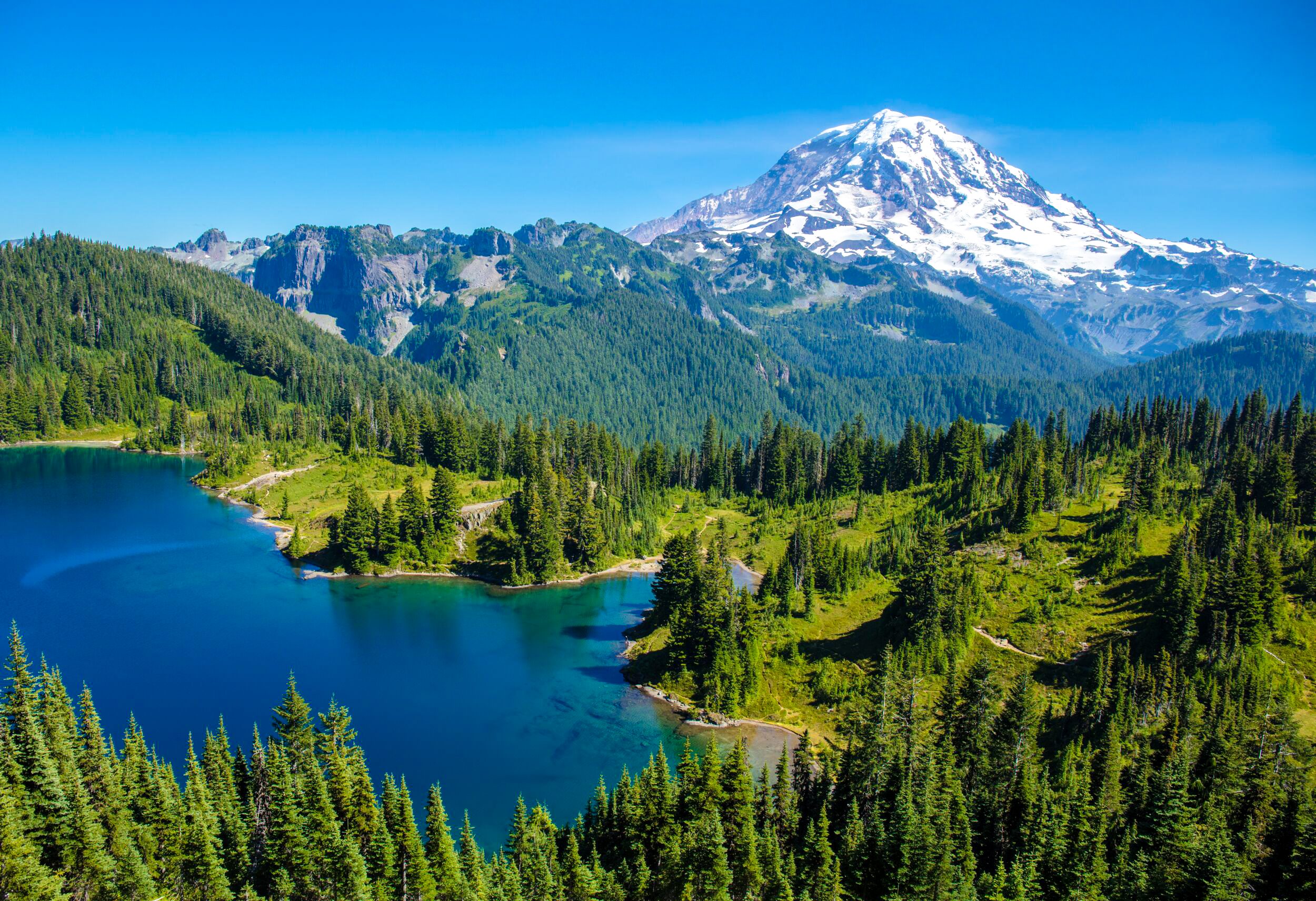
Eunice Lake - If you make it to the remote west side of the park, Eunice Lake is the hike to do. It's a beautiful area complete with a retired fire lookout and Eunice Lake resting beneath Rainier on the horizon (featured in the cover photo of this post). There is no drinking water in this area and it's about 15 miles of dirt road driving to get here. Read more about the hike here.

A few hyperlapses I shot in Mt Rainier National Park. Locations in order of appearance: the Burroughs 2, Shadow Lake, Eunice Lake, Summer Land, and the Burroughs 1

North Cascades National Park

North Cascades National Park

Best time to visit: Late Summer

Recommended Hikes: Blue Lake, Maple Pass, Hidden Lake, Sahale Arm

Ideal For: Hiking, Backpacking, Camping, Boating

Where to stay: Colonial Creek and Newhalem campgrounds, town of Marblemount

Park Website - Park Map

Useful Info:

  • Dogs - the general rule for dogs in national parks is that they must be leashed and are only allowed on paved areas, which includes parking areas, roads, and front country campgrounds. Dogs are not allowed on park trails, even when leashed.

  • The North Cascades Highway which runs through the park is closed November - April.

  • Reaching the southwest region of the park requires dirt road driving, but it’s doable in a 2-wheel drive car.

  • North Cascades is home to black bears - proper food storage is required at all times. Read more about bear safety here.

  • There is a small general store in the center of the park in the town of Newhalem, its hours are 10AM to 5PM every day. There are no other stores or services in the park.

  • Drinking water is available at the campgrounds and visitor center. Bring your water bottles to fill up.

North Cascades is located in northern Washington state, just a few hours drive from Seattle. It is one of the lesser visited national parks in the country, partly because it receives a lot of rain and snow. Late summer brings the best weather and the least amount of rain, along with snow-free hiking routes. When the clouds clear, the mountainscapes in North Cascades are as beautiful as any in the country.

Must See Attractions:

Diablo Lake - Right in the center of the park, Diable Lake is surrounded by rising mountains and has a distinctive turquoise color. There are several viewpoints, and hikers can get close to the lake's shoreline at the Ross Lake Dam and near the Colonial Creek Campground.

Washington Pass - This area is outside of North Cascades’ boundaries but it offers the best attractions that you can reach on paved roads in the park. Rewarding hikes here include Blue Lake and Maple Pass.

Cascade Pass Area - This region is more remote and requires a long drive and hike, but it's well worth it. It’s located on the southwest side of the park, at the end of a long dirt road from the town of Marblemount. The Hidden Lake and Sahale Arm hikes are both in this region. Read more about these two in the hiking section below.

Where to Stay:

Most options in or near the park are either campgrounds or RV parks. Newhalem Campground and Colonial Creek Campground are both in the central part of the park. Newhalem can be reserved in advance here. Colonial Creek is located right on the shore of Lake Diablo - it can be reserved here. There is also a few first-come-first-serve campsites in more remote areas of the park. There is an RV park in Marblemount in addition to the RV campsites at Newhalem and Colonial Creek.

A small amount of cabins are available at the Ross Lake Resort - click here for more information.

Hiking in North Cascades

Most hikes here are steep and long, but incredibly rewarding. Large elevation gains allow you to see the repeating ridge lines of the Cascade Mountains in a way that is not possible from the park road. You must be in good shape to do the hikes discussed below.

Blue Lake - The best moderate hiking option - this trail is about 4 miles roundtrip and climbs about 1,000 feet in elevation. Blue Lake is striking with an imposing rock wall backdrop. Read more about the hike here

Maple Pass - The best hike in the Washington Pass area. The trail loops around and then high above Lake Ann and Rainey Lake, and it has an stunning summit with panoramic views at Maple Pass. Read more about the hike here.

Sahale Arm - A challenging climb that offers fantastic views and possible mountain goat sightings. Most of the hike is on a steep dirt trail, but the final ascent crosses rock scree. Look for the cairns (small towers of rocks balanced on each other) which mark the easiest ascent up the rock field. Read more about the hike here.

Hidden Lake - the trail to Hidden Lake climbs 3,200 vertical feet in just 4.5 miles. Hidden Lake is a true gem, perfectly blue with a backdrop of mountains. You cannot reach the shoreline of Hidden Lake, but can descend a rock field once reaching the viewpoint to get a closer look. The dirt road up to Hidden Lake is steep and narrow with potholes, but it is doable in a two wheel drive car. Read more about the hike here.

Locations include Sahale Arm, Maple Pass, and Hidden Lake

Olympic National Park

Olympic National Park

Best time to visit: Summer

Recommended Hikes: Seven Lakes Basin, Rialto Beach, Ruby Beach, Hurricane Ridge, Hoh Rainforest

Ideal For: Hiking, Camping, Backpacking, Auto-Touring, Boating

Where to stay: North or West side of the park

Park Website - Park Map

Useful Info:

  • Dogs - the general rule for dogs in national parks is that they must be leashed and are only allowed on paved areas, which includes parking areas, roads, and front country campgrounds. Dogs are not allowed on park trails, even when leashed.

  • Olympic NP is deceptively large - It will take about 3 hours to drive from its East side to the coast. It's best to devote a full day to one area; for example, spend one day exploring the coastline, and another day in the northern mountain regions of Hurricane Ridge and Sul Doc.

  • Be prepared for weather, including rain during summer. The park service does snow plowing during winter, but only for weekends.

  • The vegetation in Olympic is dense which makes for a complete lack of viewpoints at low elevations. In order to see the mountains, you will have to drive to Hurricane Ridge or do one of the longer hikes.

  • Drinking water is available at most developed areas of the park, bring your water bottle to fill up.

Olympic is a big, mountainous national park, covering most of the Olympic Peninsula in Washington. It is very diverse with mountains and rainforests and sections of the Pacific coastline. The park receives a lot of rain and snow - summer months offer the best chance of good weather along with open hiking routes.

Must See Attractions:

Hurricane Ridge - This is the only place accessible by car where you can see the mountains in the heart of Olympic, including Mt Olympus. It's located on the north side of the park and the road is open most of the year, except on winter weekdays when there is snow. There is a visitor center at the peak and numerous hiking routes from there.

Lake Crescent - An impressive lake surrounded by rising mountains. The Lake Crescent Lodge is right on its shoreline and it’s a great place to stay, eat, or watch the sun set. Lake Crescent is located on the northern boundary of the park.

Sol Duc - This a cool area with a lodge, restaurant, and hot spring heated pools. Sol Duc Falls is really pretty and it’s just a short hike from the lodge. A longer trail to Seven Lakes Basin is also in this area and it’s a great hike - read more about it in the hiking section below.

Coastline - The park includes 73 miles of rugged coastline. The two primary coastal areas are Ruby Beach and Rialto Beach. Both offer cool rock formations with coarse sand and lots of driftwood. The Ozette area is also along the coast but requires several miles of hiking through dense vegetation to reach the ocean.

Rainforests - The Hoh and Quinault rainforests sit in the western and southern sections of the park. They are worth seeing, but if you just have a few days, I recommend focusing on the coastline and mountains instead.

Where to Stay:

In general, try to stay somewhere on the north or west boundaries of the park. Lake Crescent and Sul Doc are good central locations on the north side that have campgrounds and lodging. There are also options along the coast if you want to make the ocean the focus of your trip.  

Avoid staying on the south or east sides of the park to reduce drive times.

Hiking in Olympic

Olympic makes you work for it when it comes to hiking, but the rewards are worth the effort. Hiking at easier, lower elevations is exclusively through dense forests with tall trees and zero distant views. If you are capable of hiking in the 10-15 mile range with significant elevation gains, you can get above the tree-line for views of lakes, repeating ridge lines, and Mount Olympus.

Seven Lakes Basin - This is a strenuous hike that continues on from Sol Duc Falls, roughly 15 miles roundtrip. It can be done as a loop or an out and back (via Deer Lake), and it is also great overnight backpacking destination (permit required). I highly, highly recommend this hike, it will not disappoint! Read more about it on the park's website here.

Hurricane Ridge - There are multiple trails that take off from Hurricane Ridge. This a beautiful area high above the treeline which offers great views no matter how far you hike. Read more about the area’s hiking options here.

Rialto Beach - An awesome beach hike at Rialto goes to the "Hole-in-the-Wall" natural arch, about 2 miles one way. There are several impressive rock formations along the way. The sand is coarse and abrasive so be sure to wear solid shoes. Read more about the hike here.

Also consider researching:

Deer Park and Obstruction Point - these are both accessible via dirt roads, near the Hurricane Ridge area. From what I've read, the roads are narrow and steep, but the reviews are good. Deer Park has a first-come-first-served campground which is highly reviewed as well.

Round Lake, part of the Seven Lake Basin in Olympic National Park

Rocky Mountain National Park

Rocky Mountain National Park

COVID Info: Rocky Mountain is using a ticketed entry system this summer. Click here for more info and to reserve in advance. Masks are required on shuttles and inside park buildings.

Best time to visit: Late Spring through Early Fall

Recommended Hikes: Dream Lake, Moraine Park, Bierstadt Lake, Sprague Lake

Ideal For: Hiking, Wild-life Viewing, Backpacking, Camping, Mountain Climbing, Horse-back Riding, Auto-Touring, Boating

Where to stay: On the East side of the park 

Park Website - Park Map

Useful Info:

  • Dogs - the general rule for dogs in national parks is that they must be leashed and are only allowed on paved areas, which includes parking areas, roads, and front country campgrounds. Dogs are not allowed on park trails, even when leashed.

  • Wildlife in Rocky Mountain NP is abundant - Look for elk, deer, and black bears at the lower elevation meadows and bighorn sheep on the rocky high elevations near Trail Ridge Road. Male elk are dangerously aggressive during the fall breeding season and they will charge if you get too close. Proper food storage is required at all times to protect the park's black bears.

  • Many higher elevation hiking routes will have snow on them well into the summer - bring hiking poles for increased stability on the snow.

  • Arapaho National Recreation Area is just outside the park's western boundary - there are several big lakes here where motor-boating is permitted.

  • Estes Park is a town just outside the park's eastern boundary. There are hotels, restaurants, and grocery stores here.

  • Drinking water is available at most developed areas of the park, including visitor centers and campgrounds. Bring your water bottle to fill up.

  • There is shuttle service that runs from Moraine Park to Bear Lake during summer and fall. The service will be operating at limited capacity in 2021 due to Covid.

Rocky Mountain National Park has towering peaks, lush meadows, and picturesque lakes. An extensive network of hiking routes go deep into the mountains, especially on the east side of the park. The Trail Ridge Road, which connects the east and west sides of the park, opens at the end of May each year. The park is open year around, but winter access is only to lower elevations. Higher elevation hiking routes will be covered in snow into the summer.

Must See Attractions:

Moraine Park - Rocky Mountain National Park has a huge elk population, and they love to hang out in Moraine Park. A "park" is basically a really big meadow. The female elks congregate here in great numbers to graze and nurture their young throughout the summer, while the males stay on the fringes, preparing for the fall breeding season. Its really impressive to see them all here, bring binoculars! 

Sprague Lake - This is a tranquil lake with great views of mountain peaks rising up in the distance. There is an awesome, leisurely foot-path that goes around the lake, with a nearby parking lot and shuttle stop which makes it easy to access for all ages. 

Bear Lake - a really popular lake at the end of Bear Lake Road on the east side of the park. It is the starting point for several hikes which lead to other lakes and waterfalls in the area. Parking here fills up early; if the shuttles are running when you visit, it's worth using them to avoid the hassle of parking.

Trail Ridge Road - Open summer ONLY - Trail Ridge Road runs along a spine of Rocky Mountain peaks to connect the west and east sides of the park. There are numerous viewpoints to stop at, and also the Alpine Visitor Center which sits at an elevation of almost 12,000 feet. The road opens each year at the end of May (Memorial Day Weekend) and closes down for the winter in mid-October. 

Where to Stay:

If you are interested in hiking and wild-life viewing, the most opportunities are on the east side of the park. There are major campgrounds on the east side, one of which is reservable in advance online here. Hotels in Estes Park are a good place to stay if you are not interested in camping.

If you are interested in motor boating, you will want to stay on the west side of the park, near the Arapaho National Recreation Area.

Hiking in Rocky Mountain:

Dream Lake - This is a pretty short hike that leaves from the Bear Lake area on the east side of the park. Dream Lake has an impressive backdrop of mountain peaks and the trail to get here also passes Nymph Lake. This hike can be extended to include Emerald Lake and Lake Haiyaha. Read more about this hike here.

Bierstadt Lake to Hollowell Park - This is a good long hike that is off the beaten track. You can park at Hollowell Park and take the shuttle up to the Bierstadt Lake stop. The first part of the hike is a climb up to Bierstadt Lake which is secluded and picturesque. The trail down to Hollowell Park from here is rocky but all downhill, and Hollowell Park is a nice endpoint to the hike. Bierstadt Lake can be done as an out and back hike as well - read more about it here.

Cub Lake - A popular hike that leaves from Morraine Park. I recommend doing the Morraine Park section but not necessarily continuing on to Cub Lake. The first mile of this hike circles the perimeter of Morraine Park which is great for seeing elk. However, Cub Lake is not as pretty as many other Rocky Mountain NP lakes, so I do not recommend hiking to Cub Lake as an endpoint.

There are many hikes I haven't done in Rocky Mountain NP - I recommend researching more online or asking at the visitor centers if you are planning a trip. 

Parts that I missed:

All of the higher elevation hiking - due to too much snow when I visited in May. Some hikes to consider if you visit in late summer include Sky Pond, Glacier Gorge, and Fern Lake.

Wild Basin - This is a more remote section of the park in the south-eastern corner of the park. There are no services here or drinking water, but a network of out-and-back hiking routes. 

A few hyperlapses I shot in Rocky Mountain National Park. Locations in order of appearance: Moraine Park, Bierstadt Lake, and Hollowell Park

Sequoia National Park

Sequoia National Park

Covid Info: Shuttle service may be modified or limited in 2022. Masks are required on shuttles and inside park buildings.

Best time to visit: Year around, but avoid snow to best explore the Giant Forest

Recommended Hikes: Moro Rock, Congress Loop, Round Meadow, Crescent and Log Meadows, Pear Lake, Redwood Canyon Grove, Muir Grove

Ideal For: Hiking, Camping, Backpacking, Auto-Touring

Where to stay: In the park at numerous campgrounds and lodges

Park Website - Park Map

Useful Info:

  • Dogs - the general rule for dogs in national parks is that they must be leashed and are only allowed on paved areas, which includes parking areas, roads, and front country campgrounds. Dogs are not allowed on park trails, even when leashed.

  • Sequoia is a black bear stronghold - I have seen more bears here than anywhere else. Look for them in the meadows and the Giant Forest, especially in the morning and evening. Proper food storage is required at all times. Read more on food storage on the park's website here.

  • There is a general store at Lodgepole which sells food and souvenirs. It also has a small cafeteria that is open throughout the day from spring - fall.

  • A trip to Sequoia can be combined with a trip to nearby Yosemite National Park. Read more about Yosemite here.

  • There is no direct access to Sequoia NP from the east side of the Sierra Nevada mountain range. Sequoia's gates are open year around from the south entrance on Highway 198.

  • The General's Highway which connects the north and south entrances of Sequoia NP is closed during winter - access to the Giant Forest is open year around via the south entrance (Highway 198).

  • There is shuttle service during summer months. Try to lock down a parking space early at General Sherman or the Giant Forest Museum and then use the shuttles to get around from there. There is no charge to use the shuttles - it is included with the park entrance fee.

  • Drinking water is available at most developed areas of Sequoia, bring your water bottle to fill up.

Sequoia trees are the largest living things on Earth. Some of them are more than 3,000 years old and and they are truly awe-inspiring to witness and walk amongst. The largest trees have official names, but there are thousands more that are not named. The park also has excellent hiking routes that get out of the forrest and lead to hidden lakes with jagged peak backdrops. Sequoia is a year-around park - but be ready for snow in the winter.

Must See Attractions:

General Sherman Tree - the largest Sequoia tree in existence today. General Sherman is accessible with a short hike from a satellite parking area. Handicapped parking is available near the tree, but all others must use the satellite lot. The General Sherman parking area is also the parking lot to use to access the Congress Loop trail.

the General Sherman Tree

Congress Trail - The entire Giant Forest is worth hiking, but if you are short on time, do the Congress Trail. It includes all the famous Sequoia trees including The President, Lincoln Tree, Mckinley Tree, Chief Sequoyah, and the groups of the House and the Senate. The Congress Trail can be extended to see the rest of the Giant Forest and its meadows.

the House Group at Sequoia National Park in California

Moro Rock - This is a big granite monolith just south of the Crescent Meadow area. A stone staircase with hand railings allows people to hike up to its peak for panoramic views of the mountains and valley below. This is a great place to be during sunset or sunrise! Read more about Moro Rock in the hiking section below.

Crescent Meadow Area - John Muir called Crescent Meadow the "Gem of the Sierras". It is flanked by Huckleberry Meadow to its left and Log Meadow to it's right, with hiking paths that go around and between all three. All three meadows are must-sees, and they are great place to spot black bears, especially in the morning and evening hours. "Tharp's Log" is worth seeing as well - it’s a hollow, fallen Sequoia Tree converted into a tiny home in the late 1800s by Hale Tharp. 

Tunnel Log - A very popular photo op, Tunnel Log is a fallen Sequoia with a big hole cut in it that you can drive your car through. It's located on the road in between the Moro Rock and Crescent Meadow parking areas - you can't miss it.

Round Meadow - Round Meadow is my personal favorite meadow in the park. It is surrounded by Sequoia trees, and the open space of the meadow makes it easy to appreciate them in their entirety. The walk around Round Meadow is a must-do for every visitor of every age. The nearest parking for Round Meadow is at the lot across from the Giant Forest Museum. Read more about the walk around the meadow here

General Grant Grove - This grove of Sequoias is separated from the Giant Forest by about 25 miles, but the trees here are just as impressive. The grove is located near the park's north entrance on Highway 180, accessible from the south via the General's Highway (closed during winter). There is another "tunnel" tree here which hikers can walk through. Read more about the Grant Grove here.

Where to Stay:

There are numerous campgrounds in the park, one of which can be reserved online in advance here. The Wuksachi Lodge and Stony Creek Lodge are great options in the heart of the park if you prefer a hotel - click here and here for their websites. 

There are a few private campgorunds/RV parks and small hotels outside park boundaries and many more as you get closer to the California valley.

Hiking in Sequoia:

The Giant Forest - In my option, this is some of the best hiking in the world. It really is a moving experience to walk amongst these silent giants. Hiking trails in the Giant Forest connect General Sherman, Congress Trail, Crescent Meadow, and Moro Rock. 

Moro Rock - This is a must-do hike to the peak of Moro Rock. The hike has stairs and handrails up the side of the rock, which rises about 250 feet to its peak from the parking area. The road here is closed during winter months, but is still reachable on foot from the Giant Forest Museum. Read more about the hike here.

Pear Lake - If you want to get above the tree-line, the Pear Lake hike offers rugged mountain peaks. You will see zero Sequoia trees on this hike, but the trail passes three small Sierra lakes before reaching the biggest lake in the area - Pear Lake. This is a popular overnight backpacking destination in Sequoia as well. Read more about the hike here.

Off the Beaten Track:

Redwood Canyon Grove - This is the largest grove of Sequoias in the park. The hike can be done as a loop or an out-and-back to the Sugarbowl Grove which is really cool as well. The trailhead can be accessed on a two mile dirt road that breaks off from the General's Highway across from "Quail Flat”. Read more about it here.

Beetle and Sunset Rock - I recommend Beetle Rock over Sunset Rock if you only have time for one. Beetle rock is a much shorter hike and it can be seen in 20 minutes total. It also offers a better view of the valley than Sunset Rock. Crowds should be minimal at both locations compared to the rest of Sequoia.

hiking down from Moro Rock - Sequoia National Park in California.

Yosemite National Park

Yosemite National Park

Yosemite is doing a ticketed entry program this summer for peak hours - click here for more information to and to reserve a ticket. Park shuttles are operating at a limited capacity. Masks are required on shuttles and inside park buildings.

Best time to visit: Year Around

Recommended Hikes: the Mist Trail, John Muir Trail, Valley Loop Trail, Upper Yosemite Falls, North Dome, Cloud’s Rest, Half Dome (permit required)

Ideal For: Hiking, Biking, Rock Climbing, Camping, Auto-Touring

Where to stay: in the main valley (camping and hotel)

Park Website - Park Map

Useful Info:

  • Dogs - the general rule for dogs in national parks is that they must be leashed and are only allowed on paved areas, which includes parking areas, roads, and front country campgrounds. Dogs are not allowed on park trails, even when leashed.

  • Glacier Point Road is closed in 2022 for renovations. You can hike to Glacier Point via the 4 Mile Trail from the valley floor.

  • Yosemite is one of the country's most popular national parks. Be prepared for crowds.

  • Yosemite is home to black bears - proper food storage is required at all times.

  • There are two large general stores and food court areas in the main valley, one at the Yosemite Lodge and one in Curry Village. They sell a wide variety of things that you might need.

  • During winter months, Yosemite is only accessible from the west. Highway 120 runs from the park towards Nevada on the east, but it closes when there is snow. If you are planning a visit from the east, make sure Highway 120 is open. The park's western entrance on Highway 140 is open year-around.

  • Wilderness permit information for Yosemite can be found here.

Yosemite is one of the country’s most popular National Parks. It’s famous for towering granite walls and powerful waterfalls, most of which are found in the main valley. The waterfalls run at their peak during spring, with maximum water flow peaking during May. Summer is ideal for hiking the higher elevation trails, including Half Dome and Cloud’s Rest. Fall and winter bring rain and snow and tranquil scenery, along with smaller crowds. 

Must See Attractions:

Yosemite Falls - You will see Yosemite's most famous waterfall from many different angles in the valley. It can be enjoyed at a distance from meadows and also up close at the base of Lower Yosemite Falls. The walk to the base of Lower Yosemite Falls is short and paved, and should be done by everyone who visits. Hiking to the top of Upper Yosemite Falls is worth the effort, read more about it in the hiking section below. 

Glacier Point - Panorama vistas at Glacier Point show Yosemite Falls, Vernal and Nevada Falls, Half Dome, and the mountains surrounding the valley. It is accessible via car or hike - the drive from the valley floor to Glacier Point takes about 45 minutes, one-way. Hikers can reach Glacier Point via the "four mile trail" from the valley floor. The road to Glacier Point is closed during winter months and into the spring due to snow.

Tunnel View - The most recognized viewpoint in Yosemite Valley, with El Capitan and Bridal Veil Falls framing Half Dome in the center. This viewpoint is open year around and can be accessed from the main valley by driving a few miles up on Wawona Road (Highway 41)

Bridal Veil Falls - Arguably the prettiest of the major waterfalls in Yosemite but also the first to run dry. Bridal Veil packs a punch, but it only runs during spring when there is heavy snowmelt.  The area beneath Bridal Veil is currently under construction and not accessible to foot traffic.

Vernal and Nevada Falls - Vernal Falls has always been my favorite waterfall in Yosemite and it's a must-see for every visitor. Nevada Falls is upstream from Vernal Falls and it's really cool as well - worth seeing if you are up for a longer hike. Both waterfalls can be seen from high above at Glacier Point, but they are better enjoyed up close via the Mist Trail or John Muir Trail. Read more about them in the hiking section below. 

El Capitan Bridge - There is a huge meadow at the base of El Capitan. This is a must-see and a great place to sit down and relax and look up at El Cap. There are often people hanging out here with telescopes that you can look through to see climbers up on the rock. There is a foot trail that runs around the meadow and along the river.

Mirror Lake - Mirror Lake is a nice destination in the spring, but it dries out into a meadow by the end of summer. This part of the valley is right beneath Half Dome, providing a unique viewpoint of the monolith. It's about a 2 mile roundtrip hike to get here from the nearest shuttle stop. Read more about it on the park's website here.

Toulumne Meadows - Yosemite’s high country is best explored from Toulumne Meadows, which is far removed from the main valley on Highway 120. This part of the park is less crowded than the valley but not as visually stunning. It does still offer beautiful landscapes with impressive mountain peaks and fun hiking routes.

Where to Stay:

If possible, try to stay in the main valley. There are 3 reservable campgrounds in the main valley - they can be reserved online in advance here, here, and here. The campsites go on sale on the 15th of each month for a booking window 5 months in the future, and they can sell out within minutes for peak season weekends. Weekdays fill up slower but still sell out well in advance - book as early as possible.

There are also primitive cabins right near Curry Village that can be reserved online in advance here.

There are two hotel in the main valley, called the “Yosemite Lodge” and the "Ahwahnee Hotel”. They are expensive and the rooms are not fancy, but the location is unbeatable. This is the best option if you are unwilling to camp.

If the above options are sold out, there are a few campgrounds in the park high country along highway 120. There are also private campgrounds and cabins outside of park boundaries. 

Hiking in Yosemite

Yosemite Hiking Map

The Mist Trail - One of the best hikes in the park. The first section is paved and consistently uphill for about a mile before Vernal Falls is visible. The trail then becomes a massive set of stone steps that ascend all the way to the top of Vernal Falls This a great endpoint for the hike, but you can also continue on to see Nevada Falls which is further upriver. Be prepared to get wet from the mist when the waterfalls are running strong. Read more about the hike here.

The John Muir Trail - This is a great loop hike option which can be combined with the Mist Trail to see the top of Nevada Falls. The John Muir Trail offers great views of Nevada Falls but mostly misses Vernal Falls, although there is a really unique perspective of Vernal Falls from Clark Point.

The Valley Loop Trail - There is a loop trail that goes from one end of the valley to the other with plenty of options for customization. It flat and shady and wanders through forests and meadows that offer stunning views throughout. You can take this trail to see Mirror Lake, Upper Yosemite Falls, El Capitan, and Bridal Veil Falls. I really like the El Capitan section. It's also a good way to escape the crowds and possibly see wildlife. Read more about it here.

Upper Yosemite Falls - This is a grueling hike to the brink of Upper Yosemite Falls. At the top, there is a narrow staircase that you can walk down to a viewpoint of Yosemite Creek barreling into the valley below. Seeing the river churn over the cliff is unbelievable when the falls are flowing strong, but this hike probably isn’t worth the effort when the falls are dry. Read more about the hike here.

Sentinel Dome - This hike can be done from Glacier Point and reaches a cool vantage point which offers 360 degree views of the park. Hikers can see El Capitan, Yosemite Falls, and Half Dome in three different directions from a single vantage point atop the dome. Read more about the hike here.

North Dome - During the summer, the hike to North Dome from Yosemite’s high-country is a great option. The endpoint of the hike looks across the valley for a stunning view of Half Dome’s face. This hike is ideal when most of the snow in the high-country has melted. Read more about it here.

Clouds’ Rest - Another great option once the snow has melted in the high-country. The final ascent of Clouds’s Rest can be harrowing if you have a fear of heights, requiring a traverse across a narrow strip of granite. The viewpoint of Half Dome at the end is worth the effort. Read more about the hike here.

Half Dome - The ultimate Yosemite hike. It is a punishing 16 mile round-trip trek with a final summit up the side of Half Dome, assisted by metal cables attached to the rock. This hike is only open during summer months. PERMITS ARE REQUIRED to hike Half Dome and park rangers will check for your permit once you get near the cables. Permits are issued through an online lottery two days in advance of the hiking date.  For complete information, click here. To read more about the hike, click here.

Zion National Park

Zion National Park

Best time to visit: Year Around

Recommended Hikes: Angel's Landing, the Narrows, the Subway, Kanarra Falls (Note the East Rim Trail is closed due to rockfall. Observation Point can be reached via the East Mesa Trail)

Ideal For: Hiking, Backpacking, Camping, Canyoneering, Rock Climbing, Biking

Where to stay: Campgrounds in or near the park, towns of Springdale or Hurricane, UT

Park Website - Park Map

Useful Info:

  • Zion is open 24/7/365, and no reservations are currently required.

  • Dogs - the general rule for dogs in national parks is that they must be leashed and are only allowed on paved areas, which includes parking areas, roads, and front country campgrounds. In Zion, pets are allowed on the Pa’rus Trail, which is paved, but not on any other park trails.

  • Zion is less than a 3 hours drive from Las Vegas, which is the nearest major airport.

  • Beginning April 1, 2022, hiking Angel’s Landing will require a permit. See more info from the park website here.

  • The main Zion canyon is accessible via shuttle ONLY for most of the year. You can also enter on foot or on a bicycle.

  • Flash floods are lethal in all of Zion's slot canyons - the park monitors storms and closes the Narrows when there is flash flood potential. Check at the visitor center for the latest information about potential flash floods.

  • You can rent water shoes, hiking sticks, and bikes at stores just outside the park's south entrance. E-Biking the canyon is a great experience.

  • Highway 9, which runs from the south entrance to the east entrance of the park, goes through a low clearance tunnel. Trailers and RVs require escort which is available throughout the day, but not at night. Read more about it here.

  • Drinking water is available at the visitor center and other park buildings.

Zion is the most popular national park in Utah. The main canyon is the highlight of the park - towering sandstone cliffs that converge to form a massive slot canyon known as "the Narrows". Zion is a year-around destination and it’s usually crowded, especially on weekends. Winters are cold and summers are hot.

Must-See Attractions:

The entire main canyon is a must-see. All the shuttle stops are cool and worth jumping off at if you have time.

Angel's Landing - one of many famous rock formations in the main canyon. The monolith is best observed from shuttle stops 7 and 8 on the canyon floor. The hike to the summit of Angel’s Landing is outstanding - read more about it in the hiking section below.

the Narrows - a giant slot canyon more than 10 miles long, with sections that are just 30 feet wide and 1,000 feet high. Hiking up the river is the only way to see the Narrows - read more about it in the hiking section below.

Shuttle Stop 8 - the "Big Bend" shuttle stop offers views of vertical sandstone cliffs in every direction. There is a short trail between shuttle stops 8 and 7 that is incredibly beautiful and tranquil. This is the best place to see Angel's Landing and the Great White Throne from the canyon floor. 

Zion High-Country - Outside of the main canyon, the landscape features colorful buttes and mesas. These make for a great scenic drive on Highway 9, and potential for bighorn sheep sightings. Attractions in this area include Checkerboard Mesa, the Canyon Overlook Trail, and the East Rim Trail.

Where to Stay:

There are two campgrounds in the park, the "Watchman" campground can be reserved online in advance here. The "South" campground is available 2 weeks in advance online here. Both campgrounds are always in high demand.

There are private campgrounds just outside the park's southern and eastern boundaries. These are great options if the Watchman and the South campgrounds are full. 

There are hotel and BNB options in Springdale and Hurricane. Springdale is a tiny town just outside the park's southern boundary - the options here are nicer but more expensive. Hurricane is a larger town about 30 miles from the parks south entrance that has budget hotels.

Hiking in Zion:

Angel's Landing - The must-do hike in Zion. Angel's Landing is a challenging hike with a steep summit ascent, assisted by chains bolted to the rock for support. This hike is very crowded, especially on the steep sections near the summit. Get an early start to avoid the traffic jams! Angel’s Landing now requires a permit to hike which can be reserved here. Read more about the hike here.

the Narrows - The crown-jewel of Zion National Park. The Narrows are closed whenever the Virgin River is flowing at 150 cubic feet per second (click here for current water-flow levels). This happens throughout the spring months as winter snow melts off and occasionally in summer, fall, and winter during major rain storms. Fall and winter are great times to hike the Narrows with reduced crowds. Tough, water-friendly shoes are crucial and hiking poles or a walking stick are really helpful. You can rent all Narrows gear at stores near the park entrance.

Observation Point - This is a really popular hike to a viewpoint high above Angel's Landing. The hike is long for a single viewpoint, but there is some cool scenery on the way, especially near Echo Canyon. Due to a recent rockfall, observation Point is no longer accessible from the canyon floor. Hikers can still reach it from the Stave and East Mesa Trailheads.

the Subway - Day-hikers can access the lowest tier of the Subway with a long hike for which permits are required (reserve online here). Permits are available for the spring through fall months but they are very limited. Do not attempt this hike with shoes that can't get wet - hiking in the creek is often the easiest route. Read more about the hike here.

Zion High Country - Theres another cool canyon that runs along the park road East of the tunnel. It’s worth a hike if you are unable to get into the main canyon shuttles. Parking is along the roadside at various points.

Kanarra Falls - a really cool slot canyon with a photogenic waterfall. Kanarra Falls is outside the Zion park boundaries but its close to the Kolob Canyons section of the park. You can see Kanarra Falls and catch the Kolobs for sunset in a single day. The hike is partially in a creek so bring shoes that can get wet. Read more about the hike and finding the trailhead here. Beginning 2019, a permit is required to hike Kanarra Falls. Click here for more permit info.