Viewing entries in
Pacific Northwest

Columbia River Gorge

Columbia River Gorge

Best time to visit: Year Around

Recommended Hikes: Tunnel Falls, Wiesendanger Falls, Wahclella Falls, Tamanawas Falls

Ideal For: Hiking, Backpacking, Camping, Wind Surfing, Paddle Boarding

Where to stay: Anywhere between Portland and Hood River, on the Oregon side of the river.

Park Website

Useful Info:

  • Dogs - the Columbia River Gorge is more dog-friendly than National Parks. Most trails in the Gorge allow leashed dogs.

  • Oneonta Gorge is currently closed, but the hike to Punchbowl Falls and Tunnel Falls (Eagle Creek Trailhead) his now open after 4 years of closure.

  • There are no official park gates, but a fee is still required when parking at any Columbia River Gorge trailhead. A day pass is $5 dollars and can be deposited at trail heads with cash or purchased in advance. Federal National Park annual passes are accepted.

  • AVOID crossing the Multnomah Falls area on the Historic Columbia River Highway - use I-84 instead. The Multnomah area is a mad-house and it can take really long to get through it in a car. You can use the Historic Columbia River Highway further east to access Oneonta Gorge, Horsetail Falls, and Elowah Falls without having to pass the Multnomah area.

  • Hiking paths in the gorge are hard on the feet. They are well-developed, but often studded with jagged volcanic rocks that pop up above the dirt. Make sure to wear sturdy hiking shoes - no sandals!

  • There are two bridges that cross the Columbia River in the towns of Hood River and Cascade Locks. Both are toll bridges which cost a view dollars per crossing.

  • Cascade Locks is a small town with a grocery store and a few options for food. Hood River is a bigger town with more lodging and dining options.

  • Drinking water is available at campgrounds in the gorge and at Multnomah Falls, but not at trail-heads. Bring your water bottle to fill up.

  • There is no shuttle service at the Columbia River Gorge.

The Columbia River Gorge is famous for lush green vegetation and abundant waterfalls. The gorge is close to Portland and it can be seen as a long day-trip from the city. Summer provides the best chance of sun… rain and clouds are common in the spring, fall, and winter.

Must See Attractions:

The waterfalls of the gorge are the main attraction. Some of them are right next to the highway, while others require miles of hiking to reach. They are often small but remarkably pretty and diverse.

Multnomah Falls - The tallest and most famous waterfall in the gorge. This is the waterfall with "the bridge" that you have likely seen in photos. It can be seen from I-84 as you drive past, and it's the first major attraction you'll see if coming from Portland. You can hike all the way to the top of the waterfall or just see it from the bridge at its base. This is by far the most crowded area of the Gorge. 

Parking at Multnomah Falls - There is a big parking area near Multnomah Falls, which is accessible from I-84 from the LEFT LANE of I-84 in both directions. This is the parking area to use - from here it's a short walk under the highway to the waterfall. AVOID trying to park right next to Multnomah on the Historic Columbia River Highway (which is where google maps might take you). This road is very narrow and there is extremely limited parking here compared to the big lot off of I-84. You will get caught in a major traffic jam if you try to use this smaller lot.

Horsetail Falls - Right next to Oneonta Gorge and right along the Historic Columbia River Highway. There is a small parking lot here to stop and see the waterfall. 

Elowah Falls - At over 200 feet, Elowah is impressively tall. The water-flow of Elowah ranges dramatically from a wisp in late summer to a roaring drop during wet months. You can extend the hike to see Upper McCord Creek Falls, but it's not a must-see compared to Elowah. Read more about the hike to Elowah Falls here.

Wahclella Falls - This is a shorted waterfall but it flows from a deep canyon which is really impressive. Seeing Wahclella Falls requires about 2 miles of hiking which is well worth the effort. Read more about it here.

Silver Falls State Park - Worth mentioning as it is very similar to the Gorge, although it is further south near the town of Salem, Oregon. If you only have one day, I actually recommend Silver Falls instead of the Gorge. There is an incredible hike here called the "Trail of Ten Falls" which features 10 waterfalls that can all be seen in one day.

Where to Stay:

If you are visiting Portland, the Gorge can be done as a long day trip. You should have enough time to see a few major waterfalls and do one of the shorter hikes in a single day. 

Hood River is closer to the waterfalls than Portland, but it will still be a daily drive of about 20 minutes, one way. There are numerous lodging options, as well as activities for visitors, including windsurfing on the Columbia River.

There are several campgrounds along the stretch of the gorge in between Portland and Hood River. One of them can be reserved online in advance here.

Hiking in the Columbia River Gorge

Tunnel Falls - This hike was just reopened in summer 2021, having previously been closed since a 2017 wildfire. A great turn-around point for the hike is Tunnel Falls, a large waterfall with a cool tunnel that runs behind it. If you reach this area, there is another big waterfall a little further up the trail thats worth seeing as well. Use the “Eagle Creek” trailhead to start this hike.

Multnomah Falls Loop to Wahkeena Falls - This is a good long hike that passes 4 major waterfalls, including the top of Multnomah Falls. Park at the Multnomah main lot and start either up to the top of Multnomah Falls or west towards Wahkeena Falls - the trails are well marked. The other two waterfalls on the loop are Fairy Falls and Wiesendager Falls, both are really cool. Read more about the hike here.

Tamanawas Falls - This one requires a further drive - the trailhead is about 30 miles south of Hood River along Highway 35. Tamanawas Falls stands out from most Gorge waterfalls as it is really wide with heavy water flow. The rock recedes behind the waterfall, so hikers can scramble up to the cavern behind it if physically able. Read more about the hike here.

Dry Creek Falls - A decent hike but not quite as cool as the ones mentioned above. The hike is a small section of Pacific Crest Trail which crosses the Columbia River at Cascade Locks. This is a good place to find some solitude. Dry Creek Falls is a nice endpoint, but it’s the only waterfall on the hike.

Crater Lake National Park

Crater Lake National Park

Best time to visit: Summer

Recommended Hikes: Wizard Island, Garfield Peak, Mount Scott, Rim Trail, the Watchman

Ideal For: Camping, Auto-Touring, Hiking

Where to stay: Hotels or campgrounds in the park

Park Website - Park Map

Useful Info:

  • Dogs - the general rule for dogs in national parks is that they must be leashed and are only allowed on paved areas, which includes parking areas, roads, and front country campgrounds. Dogs are not allowed on park trails, even when leashed.

  • The south entrance to Crater Lake NP is open year around. During winter, there is one small viewpoint to see the lake - everything else is covered in deep snow. The north entrance to the park and the west rim drive open in late May or early June, and the east rim drive usually opens in early July. These roads close each year on November 1, or earlier if there is heavy snowfall.

  • Boat tours on the lake run when the east rim drive is open, which is roughly from July - September. Advanced reservations can be made online here.

  • All boat tours leave from Fleetwood Cove on the north side of the lake. To reach the lakeshore, visitors must hike down (and up) about 700 vertical feet from the rim. This is the only place where you can access the lake's shore.

  • There is limited lodging, gas, and food available at Rim Village and Mazama Village on the south side of the lake.

  • Crater Lake can be seen as a long day-trip if you are driving through Oregon. Even just an hour or two here will leave a lasting impression.

  • Drinking water is available at the developed areas on the south side of the lake - bring your water bottle to fill up.

Crater Lake is arguably the prettiest lake on Earth. The lake's blue color is intensely deep and vibrant, almost redefining the color itself. The park receives heavy snowfall each year, making winter and spring less than ideal times to visit. Summer is by far the best time to visit for good weather and access to the park's rim road and hiking trails. Boat tours run around the lake and to Wizard Island during the summer half of the year.

Must See Attractions:

Rim Road - There is a road that goes around the entire lake which has a ton of viewpoints - they are all worth stopping at if you have the time. Driving the full loop will take about an hour, not including stops. The entire loop is only open from July - October, but the western portion of it is open for longer. Read more about road access in the useful info below.

Wizard Island - When the boat tours are running, you can visit Wizard Island - a cinder cone volcano that rises up out of the lake. There is great hiking here to the top of the cinder cone and to Fumarole Bay, which has a swimming dock. Wizard Island is also a popular spot for fishing. You can book boat tours online in advance here

Phantom Ship - A cool little island on the south side of the lake. There is a viewpoint to see it which requires a short hike called "Sun Notch". Some of the boat tours go to this part of the lake also if you want to see Phantom Ship up close.

The Pinnacles - An area of jagged volcanic rock formations a few miles south of the lake. There is a single out and back road the runs to the Pinnacles overlook from the east rim drive.

Where to Stay:

There are cabins and a campground at Manzama Village on the south side of the lake - click here for the website. There is also a historic hotel called the "Crater Lake Lodge" which sits on the south rim. It has a restaurant, deck, and rooms that have views of the lake. The lodge can be booked online here. Book as early as possible - everything fills up in advance. 

There is also a small, first-come-first-served campsite in the park called Lost Creek Campground, but it only has a handful of campsites. It is located on the road which runs out to the Pinnacles.

If you can't secure affordable lodging in the park, the small city of Klamath Falls is about an hour's drive south of the park. 

Hiking in Crater Lake:

There are a handful of hikes that climb to peaks surrounding the rim, including the Watchman, Garfield Peak, and Mount Scott. All of them are covered in snow well into the summer, so they are best done during late summer or early autumn.

The Watchman is the shortest of the three hikes and leads to a nice viewpoint high above Wizard Island. The trail is well maintained is a good option for anyone who wants to reach a highpoint without too much effort. Read more about the hike here.

Garfield Peak is a longer hiking option and my personal favorite in the park. The peak offers great views of the lake and is a good vantage point to see the Phantom Ship island. Read more about the hike to Garfield Peak here.

Mount Scott is the longest hiking option in the park and it reaches the highest peak in the park as well. While the hike is fun, it’s worth noting that the view from the peak is pretty far from the lake and doesn’t quite compare to the close-up views at Garfield Peak or the Watchman. There is a fire lookout station at the peak and great views of the landscape surrounding the crater. Read more about the hike here.

There is another great trail that runs along the rim from the Rim Village to the Watchman on the crater's south-west side. This hike is perfect for getting out of the car and away from the crowds with continuous views of the lake as you hike. This trail is relatively flat compared to the three peaks discussed above.

Wizard Island - only accessible via boat tour during summer months. The summit of the cinder cone is an awesome short hike, and if you move quickly, you can also see Fumarole Bay on a standard 3-hour visit.

Lassen Volcanic National Park

Lassen Volcanic National Park

Best time to visit: Summer

Recommended Hikes: Lassen Peak, the Cinder Cone, Bumpass Hell, Manzanita Lake, Brokeoff Mountain

Ideal For: Hiking, Backpacking, Camping, Fishing, Auto-Touring

Where to stay: Campgrounds in the park

Park Website - Park Map

Useful Info:

  • Dogs - the general rule for dogs in national parks is that they must be leashed and are only allowed on paved areas, which includes parking areas, roads, and front country campgrounds. Dogs are not allowed on park trails, even when leashed.

  • Lassen gets a ton of snow each year. While the park is open year around, the dirt roads and the peak are closed throughout the winter half of the year. The paved road which connects the parks west and south entrances is closed until mid-June each year (opening date varies).

  • Only the western side of the park is accessible via paved road. In order to get to the Cinder Cone at the north-east side of the park and Juniper Lake at the south-east side, you will need to drive on well maintained dirt roads (open summer only).

  • Hot springs are dangerous - do not leave boardwalks when hiking near thermal features as the ground is sometimes thin and brittle and sits just above boiling hot water.

  • Drinking water is available at campgrounds and visitor centers. Bring your water bottle to fill up.

  • There is no shuttle service at Lassen Volcanic NP.

Lassen is a landscape of volcanic features with peaks, hot springs, and crags. It is open year around, but heavy snowfall closes most of the park for the winter half of the year. Visiting in summer allows access to Lassen Peak and the more remote sections of the park that require travel on dirt roads. 

Must See Attractions:

the Cinder Cone - This is my favorite feature of Lassen. Its a giant pile of loose volcanic gravel that piled up over months of continuous eruptions, some 350 years ago. It's located on the north-east side of the park, and is accessible via a dirt road into the park from Highway 44. There is a steep and exhausting hiking path that goes to the top of the cone and around its central crater, with views of Lassen Peak in the distance. Read more in the hiking section below.

Lassen Peak - The highest point on the park road is right next to Lassen Peak, allowing visitors to get close to it and even hike it if they are able. There are two picturesque lakes at is base to enjoy as well. Snow lasts well into summer on the peak.

Bumpass Hell - Lassen has a number of thermal features, mostly located on the south side of the park. Bumpass Hell is one of the larger thermal areas that can be accessed via hiking route. The hike is about 3 miles roundtrip, but it is closed when there is snow on the ground, which can last well into summer. Read more about the hike here.

Manzanita Lake - A big lake with a great view of Lassen Peak, Manzanita is located just inside the parks north west entrance. There is a great hiking path around the lake, and you can rent kayaks, canoes, and paddle boards at the Manzanita Camp Store. Motorless boats are allowed on Manzanita Lake as well.

Where to Stay:

There are several campgrounds within the park - Manzanita Lake is the biggest and it can be reserved online in advance here. It also has cabins which can be reserved online here. Manzanita Lake has showers and a general store. Other campgrounds in the park are open summer only - see the park website here for more information.

Hotel options are very limited near the park, but there are more choices towards the city of Redding for visitors who are willing to drive to and from the park each day. Camping or staying in the cabins is the best option to reduce daily drive times.

Hiking in Lassen:

Cinder Cone - My favorite hike in the park because it's so unique. The Cinder Cone is about 700 feet tall, and the hike to it's peak is very steep by hiking path standards. It is made of lose volcanic gravel which makes climbing exhausting, similar to climbing on sand. The peak offers great views in all directions, including Lassen Peak. Read more about the hike here.

Lassen Peak - A good challenge for fit hikers, Lassen Peak can be summited during late summer with no technical skills or equipment required. The peak is an awesome endpoint with plenty of room to spread out and enjoy views of the park and nearby Mt Shasta on clear days. There is snow on the trail well into the summer, hiking poles and even crampons are useful for hiking on snow. Read more about the hike here

Crag Lake - A sweet four mile round trip to the tiny green gem Crag Lake. The trailhead is near the Manzanita Lake turnoff. The lake can run dry in late summer/fall but it's a good hiking option in the spring and early summer when some of the other routes in the park are closed due to snow. 

Manzanita Lake - An enjoyable and flat hike around one of the park's prettiest lakes. This can be extended to include nearby Reflection Lake as well and is a good option in all seasons.

Parts that I missed:

King's Creek - Hikes in this area lead to thermal features and King's Creek Falls. Best to visit in late summer as snow lingers in this area into July.

Juniper Lake area - Located on the remote south east side of the park, Juniper Lake is the biggest lake in the park. There looks to be numerous hiking routes in this area to nearby smaller lakes and thermal features. Motor boats are not allowed, but this is a popular place to kayak, canoe, and camp. This part of the park is closed during winter months.

A few hyperlapses I shot in Lassen Volcanic National Park. Locations In order of appearance: Crag Lake, Cinder Cone, Manzanita Lake, Paradise Meadow, Cinder Cone

Mount Rainier National Park

Mount Rainier National Park

Best time to visit: Late Summer

Recommended Hikes: the Burroughs, Pinnacle Saddle, Eunice Lake, Comet Falls, Summer Land Meadow, Skyscraper Peak

Ideal For: Hiking, Backpacking, Camping, Auto-Touring, Mountain Climbing

Where to stay: Paradise, Longmire, or Sunrise areas

Park Website - Park Map

Useful Info:

  • Dogs - the general rule for dogs in national parks is that they must be leashed and are only allowed on paved areas, which includes parking areas, roads, and front country campgrounds. Dogs are not allowed on park trails, even when leashed.

  • The people of Washington love the outdoors and they take advantage of nearby Mount Rainier - expect big crowds throughout the park, especially on weekends and during summer. Wait times at park gates can exceed an hour on really crowded days.

  • It takes a long time to drive around the mountain. The drive from Sunrise to Paradise will take about an hour and a half and may include a long wait at the park entrances. Try to devote a full day to each area to cut down on daily drive times.

  • Snow lasts well into summer on the higher elevation hiking routes. Many of the hikes discussed in the hiking section below are only doable during late summer or with snow hiking skills.

  • Mount Rainier forms its own clouds! For this reason, it is often hidden behind them. Visit in late summer for the best weather, but also look to enjoy wild flowers, hikes, and lakes when you can't see the peak.

  • Some of the larger mammals in Mount Rainier include deer, mountain goats, and black bears. Look for goats in the high-elevation, rocky areas of Sunrise, and look for bears in meadows throughout the park.

  • There is no drinking water available in the Mowich Lake area, be sure to bring plenty of water if you want to do the Eunice Lake hike. Drinking water is available throughout most of the rest of park, bring your bottle to fill up.

  • There is limited shuttle service in the Paradise area for overflow parking. The shuttle is free and necessary to use if you can't find parking.

Mount Rainier is the largest volcano in the Cascade Range. The peak is awe-inspiring and is covered by massive glaciers. Surrounding the mountain on all sides are towering volcanic crags, ridges, lakes, and waterfalls. Visiting in late summer provides the best likelihood of good weather and views of the mountain unobstructed by clouds. The park is open year around, but much of the park road is closed when there is snow.

Must See Attractions:

Paradise Park - A wide open meadow with outstanding views of Rainier’s south face. There are multiple hiking trails that make their way towards Rainier's glaciers and viewpoints of waterfalls. Expect this area to be quite crowded with limited parking.

Reflection Lakes - Just east of Paradise and right next to the main park road. The lakes are at their stillest and most reflective in the early morning. 

Grove of the Patriarchs - If you like big trees, the Grove of the Patriarchs is worth seeing. There is a cool system of boardwalks in the heart of the grove that is fun for all ages and a nice place to relax. Visit in the morning or evening for smaller crowds.

Sunrise - Located on the north eastern side of the park, Sunrise offers the best network of day hiking options in the park. It's also is the highest accessible elevation you can reach in a car and it's great for admiring the largest glaciers on Rainier. Get here in the morning to enjoy the rising sun shining on the mountain.

Mowich Lake - Found in the remote western region of the park - this area is accessible via a dirt road from the town of Fairfax, WA. There are several hiking routes here, including Eunice Lake which is one my favorite destinations in the park (read more about the Eunice Lake hike below). This part of the park is closed during winter. 

Where to Stay:

There are two rustic hotels within the park boundaries, at Paradise and Longmire. See more information about all lodging options near the park here

There are developed campgrounds in all three areas of Mount Rainier. Cougar Rock Campground, near Paradise, is the largest and it can be reserved online in advance here. The Ohanapecosh Campground can also be reserved in advance here and its location is ideal for seeing both sides of the mountain. The White River campground is first-come-first-served only, located in the Sunrise Area.

Hiking in Mount Rainier:

Mount Rainier has a ton of great day hikes, overnight backpacking routes, and for the truly ambitious, the peak of Rainier itself. The Wonderland Trail goes all the way around the mountain, usually tackled as a 5-7 day backpacking trip. The below are my recommendations for day-hikes, but I recommend reading up on the peak and the Wonderland Trail if those interest you.

the Burroughs - Located in the Sunrise area, the Boroughs are a great place to admire Rainier's glaciers and to see mountain goats. The hike climbs up a set of three volcanic hills on it's way to the highest day-hiking elevation in the park. Read more about the Burroughs hike here

Summerland Meadow - This is a day hike on a section of the Wonderland trail (the Wonderland Trail goes all the way around Mt Rainier). Most of the day-hike is through forest, but it opens up when you reach Summerland Meadow. You can continue past Summerland Meadow to see a waterfall and a small turquoise lake surrounded by volcanic ridges. Read more about this hike here.

Skyscraper Mountain - This hike is great for escaping the crowds and reaching a peak with a great view of Rainier. The trailhead starts at the Sunrise visitor center and shares a route with the Burroughs hike until it breaks off onto the Wonderland Trail. From here it crosses Berkeley Park which is awesome in its own right, before a steep climb to reach Skyscraper Peak. I highly recommend this hike, it might be my favorite in the park! Read more about it here

Pinnacle Saddle - This is a great hike up a volcanic ridge on the south side of the mountain. The trailhead starts across the road from Reflection Lake and it offers great views of Rainier and Mt Adams once you reach the saddle. Read more about the hike here.

Comet Falls - Arguably the best waterfall in the park - Comet Falls is a great endpoint for your hike, or you can continue on to Van Trump Park. I recommend hiking to Comet Falls, but Van Trump Park can be skipped in favor of Paradise Park or Berkeley Park. Read more about the hike here.

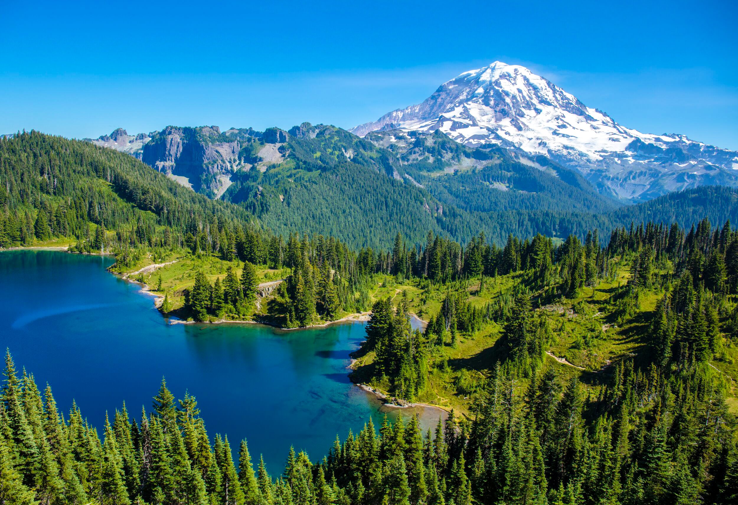
Eunice Lake - If you make it to the remote west side of the park, Eunice Lake is the hike to do. It's a beautiful area complete with a retired fire lookout and Eunice Lake resting beneath Rainier on the horizon (featured in the cover photo of this post). There is no drinking water in this area and it's about 15 miles of dirt road driving to get here. Read more about the hike here.

A few hyperlapses I shot in Mt Rainier National Park. Locations in order of appearance: the Burroughs 2, Shadow Lake, Eunice Lake, Summer Land, and the Burroughs 1

North Cascades National Park

North Cascades National Park

Best time to visit: Late Summer

Recommended Hikes: Blue Lake, Maple Pass, Hidden Lake, Sahale Arm

Ideal For: Hiking, Backpacking, Camping, Boating

Where to stay: Colonial Creek and Newhalem campgrounds, town of Marblemount

Park Website - Park Map

Useful Info:

  • Dogs - the general rule for dogs in national parks is that they must be leashed and are only allowed on paved areas, which includes parking areas, roads, and front country campgrounds. Dogs are not allowed on park trails, even when leashed.

  • The North Cascades Highway which runs through the park is closed November - April.

  • Reaching the southwest region of the park requires dirt road driving, but it’s doable in a 2-wheel drive car.

  • North Cascades is home to black bears - proper food storage is required at all times. Read more about bear safety here.

  • There is a small general store in the center of the park in the town of Newhalem, its hours are 10AM to 5PM every day. There are no other stores or services in the park.

  • Drinking water is available at the campgrounds and visitor center. Bring your water bottles to fill up.

North Cascades is located in northern Washington state, just a few hours drive from Seattle. It is one of the lesser visited national parks in the country, partly because it receives a lot of rain and snow. Late summer brings the best weather and the least amount of rain, along with snow-free hiking routes. When the clouds clear, the mountainscapes in North Cascades are as beautiful as any in the country.

Must See Attractions:

Diablo Lake - Right in the center of the park, Diable Lake is surrounded by rising mountains and has a distinctive turquoise color. There are several viewpoints, and hikers can get close to the lake's shoreline at the Ross Lake Dam and near the Colonial Creek Campground.

Washington Pass - This area is outside of North Cascades’ boundaries but it offers the best attractions that you can reach on paved roads in the park. Rewarding hikes here include Blue Lake and Maple Pass.

Cascade Pass Area - This region is more remote and requires a long drive and hike, but it's well worth it. It’s located on the southwest side of the park, at the end of a long dirt road from the town of Marblemount. The Hidden Lake and Sahale Arm hikes are both in this region. Read more about these two in the hiking section below.

Where to Stay:

Most options in or near the park are either campgrounds or RV parks. Newhalem Campground and Colonial Creek Campground are both in the central part of the park. Newhalem can be reserved in advance here. Colonial Creek is located right on the shore of Lake Diablo - it can be reserved here. There is also a few first-come-first-serve campsites in more remote areas of the park. There is an RV park in Marblemount in addition to the RV campsites at Newhalem and Colonial Creek.

A small amount of cabins are available at the Ross Lake Resort - click here for more information.

Hiking in North Cascades

Most hikes here are steep and long, but incredibly rewarding. Large elevation gains allow you to see the repeating ridge lines of the Cascade Mountains in a way that is not possible from the park road. You must be in good shape to do the hikes discussed below.

Blue Lake - The best moderate hiking option - this trail is about 4 miles roundtrip and climbs about 1,000 feet in elevation. Blue Lake is striking with an imposing rock wall backdrop. Read more about the hike here

Maple Pass - The best hike in the Washington Pass area. The trail loops around and then high above Lake Ann and Rainey Lake, and it has an stunning summit with panoramic views at Maple Pass. Read more about the hike here.

Sahale Arm - A challenging climb that offers fantastic views and possible mountain goat sightings. Most of the hike is on a steep dirt trail, but the final ascent crosses rock scree. Look for the cairns (small towers of rocks balanced on each other) which mark the easiest ascent up the rock field. Read more about the hike here.

Hidden Lake - the trail to Hidden Lake climbs 3,200 vertical feet in just 4.5 miles. Hidden Lake is a true gem, perfectly blue with a backdrop of mountains. You cannot reach the shoreline of Hidden Lake, but can descend a rock field once reaching the viewpoint to get a closer look. The dirt road up to Hidden Lake is steep and narrow with potholes, but it is doable in a two wheel drive car. Read more about the hike here.

Locations include Sahale Arm, Maple Pass, and Hidden Lake

Olympic National Park

Olympic National Park

Best time to visit: Summer

Recommended Hikes: Seven Lakes Basin, Rialto Beach, Ruby Beach, Hurricane Ridge, Hoh Rainforest

Ideal For: Hiking, Camping, Backpacking, Auto-Touring, Boating

Where to stay: North or West side of the park

Park Website - Park Map

Useful Info:

  • Dogs - the general rule for dogs in national parks is that they must be leashed and are only allowed on paved areas, which includes parking areas, roads, and front country campgrounds. Dogs are not allowed on park trails, even when leashed.

  • Olympic NP is deceptively large - It will take about 3 hours to drive from its East side to the coast. It's best to devote a full day to one area; for example, spend one day exploring the coastline, and another day in the northern mountain regions of Hurricane Ridge and Sul Doc.

  • Be prepared for weather, including rain during summer. The park service does snow plowing during winter, but only for weekends.

  • The vegetation in Olympic is dense which makes for a complete lack of viewpoints at low elevations. In order to see the mountains, you will have to drive to Hurricane Ridge or do one of the longer hikes.

  • Drinking water is available at most developed areas of the park, bring your water bottle to fill up.

Olympic is a big, mountainous national park, covering most of the Olympic Peninsula in Washington. It is very diverse with mountains and rainforests and sections of the Pacific coastline. The park receives a lot of rain and snow - summer months offer the best chance of good weather along with open hiking routes.

Must See Attractions:

Hurricane Ridge - This is the only place accessible by car where you can see the mountains in the heart of Olympic, including Mt Olympus. It's located on the north side of the park and the road is open most of the year, except on winter weekdays when there is snow. There is a visitor center at the peak and numerous hiking routes from there.

Lake Crescent - An impressive lake surrounded by rising mountains. The Lake Crescent Lodge is right on its shoreline and it’s a great place to stay, eat, or watch the sun set. Lake Crescent is located on the northern boundary of the park.

Sol Duc - This a cool area with a lodge, restaurant, and hot spring heated pools. Sol Duc Falls is really pretty and it’s just a short hike from the lodge. A longer trail to Seven Lakes Basin is also in this area and it’s a great hike - read more about it in the hiking section below.

Coastline - The park includes 73 miles of rugged coastline. The two primary coastal areas are Ruby Beach and Rialto Beach. Both offer cool rock formations with coarse sand and lots of driftwood. The Ozette area is also along the coast but requires several miles of hiking through dense vegetation to reach the ocean.

Rainforests - The Hoh and Quinault rainforests sit in the western and southern sections of the park. They are worth seeing, but if you just have a few days, I recommend focusing on the coastline and mountains instead.

Where to Stay:

In general, try to stay somewhere on the north or west boundaries of the park. Lake Crescent and Sul Doc are good central locations on the north side that have campgrounds and lodging. There are also options along the coast if you want to make the ocean the focus of your trip.  

Avoid staying on the south or east sides of the park to reduce drive times.

Hiking in Olympic

Olympic makes you work for it when it comes to hiking, but the rewards are worth the effort. Hiking at easier, lower elevations is exclusively through dense forests with tall trees and zero distant views. If you are capable of hiking in the 10-15 mile range with significant elevation gains, you can get above the tree-line for views of lakes, repeating ridge lines, and Mount Olympus.

Seven Lakes Basin - This is a strenuous hike that continues on from Sol Duc Falls, roughly 15 miles roundtrip. It can be done as a loop or an out and back (via Deer Lake), and it is also great overnight backpacking destination (permit required). I highly, highly recommend this hike, it will not disappoint! Read more about it on the park's website here.

Hurricane Ridge - There are multiple trails that take off from Hurricane Ridge. This a beautiful area high above the treeline which offers great views no matter how far you hike. Read more about the area’s hiking options here.

Rialto Beach - An awesome beach hike at Rialto goes to the "Hole-in-the-Wall" natural arch, about 2 miles one way. There are several impressive rock formations along the way. The sand is coarse and abrasive so be sure to wear solid shoes. Read more about the hike here.

Also consider researching:

Deer Park and Obstruction Point - these are both accessible via dirt roads, near the Hurricane Ridge area. From what I've read, the roads are narrow and steep, but the reviews are good. Deer Park has a first-come-first-served campground which is highly reviewed as well.

Round Lake, part of the Seven Lake Basin in Olympic National Park